world.wikisort.org - Etats-Unis
La ville de Bloomfield est le siège du comté de Stoddard, situé dans l'État du Missouri, aux États-Unis. Lors du recensement de 2010, elle comptait 1 933 habitants.
Pour les articles homonymes, voir Bloomfield.
Cet article est une ébauche concernant une localité du Missouri.
Vous pouvez partager vos connaissances en l’améliorant (comment ?) selon les recommandations des projets correspondants.
| Bloomfield | ||||
 Stars and Stripes Museum | ||||
| Administration | ||||
|---|---|---|---|---|
| Pays | ||||
| État | ||||
| Comté | Stoddard | |||
| Type de localité | City | |||
| Maire | Scott Staggs | |||
| Code ZIP | 63825 | |||
| Code FIPS | 29-06382 | |||
| GNIS | 0714383 | |||
| Indicatif(s) téléphonique(s) local (locaux) | 573 | |||
| Démographie | ||||
| Population | 1 933 hab. (2010) | |||
| Densité | 552 hab./km2 | |||
| Géographie | ||||
| Coordonnées | 36° 53′ 16″ nord, 89° 55′ 48″ ouest | |||
| Altitude | 147 m |
|||
| Superficie | 350 ha = 3,5 km2 | |||
| · dont terre | 3,5 km2 (100 %) | |||
| · dont eau | 0 km2 (0 %) | |||
| Fuseau horaire | CST (UTC-6) | |||
| Localisation | ||||
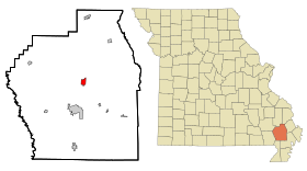 Carte du comté de Stoddard. | ||||
| Géolocalisation sur la carte : États-Unis
Géolocalisation sur la carte : États-Unis
Géolocalisation sur la carte : Missouri
| ||||
| modifier |
||||


Source
- (en) Cet article est partiellement ou en totalité issu de l’article de Wikipédia en anglais intitulé « Bloomfield, Missouri » (voir la liste des auteurs).
 Portail du Missouri
На других языках
[en] Bloomfield, Missouri
Bloomfield is a city in Stoddard County, Missouri, United States. The population was 1,933 at the 2010 census. It is the county seat of Stoddard County.[4] In September 1864 during the Civil War, the town was reduced to ashes.- [fr] Bloomfield (Missouri)
Текст в блоке "Читать" взят с сайта "Википедия" и доступен по лицензии Creative Commons Attribution-ShareAlike; в отдельных случаях могут действовать дополнительные условия.
Другой контент может иметь иную лицензию. Перед использованием материалов сайта WikiSort.org внимательно изучите правила лицензирования конкретных элементов наполнения сайта.
Другой контент может иметь иную лицензию. Перед использованием материалов сайта WikiSort.org внимательно изучите правила лицензирования конкретных элементов наполнения сайта.
2019-2026
WikiSort.org - проект по пересортировке и дополнению контента Википедии
WikiSort.org - проект по пересортировке и дополнению контента Википедии