world.wikisort.org - USA
Yoder is an unincorporated community in Reno County, Kansas, United States.[1] As of the 2020 census, the population of the community and nearby areas was 165.[2] It is located approximately 10 miles southeast of the city of Hutchinson on K-96. Although Yoder is unincorporated, with no city government, it does have a U.S. Post Office and its own ZIP code (67585). Yoder is the hub of a local Amish community.
Yoder, Kansas | |
|---|---|
Unincorporated community | |
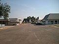
 Hardware & Lumber (2014) | |
 KDOT map of Reno County (legend) | |
 Yoder  Yoder | |
| Coordinates: 37°56′25″N 97°52′6″W[1] | |
| Country | United States |
| State | Kansas |
| County | Reno |
| Township | Yoder |
| Founded | 1889 |
| Named for | Valentine Yoder |
| Area | |
| • Total | 37.6 sq mi (97.5 km2) |
| • Land | 37.2 sq mi (96.5 km2) |
| • Water | 0.4 sq mi (1.0 km2) |
| Elevation | 1,539 ft (469 m) |
| Population (2020)[2] | |
| • Total | 165 |
| • Density | 4.4/sq mi (1.7/km2) |
| Time zone | UTC-6 (CST) |
| • Summer (DST) | UTC-5 (CDT) |
| ZIP code | 67585 |
| Area code | 620 |
| FIPS code | 20-80750 [1] |
| GNIS ID | 473653 [1] |
| Website | yoderkansas.com |
History
The community derives its name from its Amish founder, Valentine Yoder.
The first post office in Yoder was established in November 1889.[3]
The community was home to the former Naval Air Station Hutchinson, later renamed to Hutchinson Air Force Station, and currently named as Sunflower Aerodrome Gliderport.
Geography
Climate
The climate in this area is characterized by hot, humid summers and generally mild to cool winters. According to the Köppen Climate Classification system, Yoder has a humid subtropical climate, abbreviated "Cfa" on climate maps.[4]
Demographics
| Historical population | |||
|---|---|---|---|
| Census | Pop. | %± | |
| 2010 | 194 | — | |
| 2020 | 165 | −14.9% | |
| U.S. Decennial Census | |||
For statistical purposes, the United States Census Bureau has defined Yoder as a census-designated place (CDP).
Education
The community is served by Haven USD 312 public school district.
Area events
Yoder Heritage Day takes place annually on the fourth Saturday in August.[5]
Gallery
 Looking south down Main Street (2006)
 Demelia's Quilt Co (2014)
 Discount Grocery (2014)
 Horse-drawn carriage (2003)


References
- "Yoder, Kansas", Geographic Names Information System, United States Geological Survey, United States Department of the Interior
- "Profile of Yoder, Kansas (CDP) in 2020". United States Census Bureau. Archived from the original on March 28, 2022. Retrieved March 28, 2022.
- "Kansas Post Offices, 1828-1961". Kansas Historical Society. p. 2. Retrieved June 22, 2014.
- Climate Summary for Yoder, Kansas
- Yoder Heritage Day
Further reading
External links
- Community of Yoder
- Yoder Heritage Day.
- "Yoder Amish Settlement". Amish State Guide.
- Reno County maps: Current, Historic, KDOT
Municipalities and communities of Reno County, Kansas, United States | ||
|---|---|---|
County seat: Hutchinson | ||
| Cities |  | |
| Unincorporated communities | ||
| Ghost towns | ||
| Townships |
| |
| Footnotes | †This community is designated a Census-Designated Place (CDP) by the United States Census Bureau. | |
| ||
На других языках
- [en] Yoder, Kansas
[ru] Йодер (Канзас)
Йодер (англ. Yoder) — межобщинная территория, расположенная в округе Рино, в центральной части штата Канзас. Йодер является статистически обособленной местностью. Несмотря на то, что Йодер — межобщинная территория без правительства, здесь имеется почтовое отделение и собственный почтовый индекс (67585). По данным переписи населения, в 2010 году численность населения составляла 194 человека[1], а к 2020 году сократилось на 15% (165 человек). Хотя Йодер до сих пор сохраняет почтовое отделение, большинство домов в Йодере фактически имеют адрес соседней общины Хейвен.Другой контент может иметь иную лицензию. Перед использованием материалов сайта WikiSort.org внимательно изучите правила лицензирования конкретных элементов наполнения сайта.
WikiSort.org - проект по пересортировке и дополнению контента Википедии