world.wikisort.org - USA
Yellepit was an unincorporated community in Benton County, Washington, United States, located approximately three miles southwest of Wallula on the west bank of the Columbia River.
Yellepit, Washington | |
|---|---|
Former unincorporated community | |
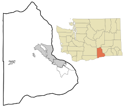 Yellepit, Washington Location of Yellepit, Washington | |
| Coordinates: 46°03′39″N 118°57′05″W[1] | |
| Country | United States |
| State | Washington |
| County | Benton |
| Elevation | 341 ft (104 m) |
| Time zone | UTC-8 (Pacific (PST)) |
| • Summer (DST) | UTC-7 (PDT) |
| ZIP code | 99337 |
| Area code(s) | 509 |
| GNIS feature ID | 1511443[2] |
History
The community was named Yellepit in honor of a chief of the Walla Walla tribe who was encountered by the Lewis and Clark Expedition.[3] The community once had a large train depot, water tank and other buildings. In 1953 the community site was inundated by the waters of Lake Wallula.[4]
References
- "Yellepit". Geographic Names Information System. United States Geological Survey. Retrieved 2012-10-28.
- "US Board on Geographic Names". United States Geological Survey. 2007-10-25. Retrieved 2008-01-31.
- "Station Roster Master List: Yellepit". Northern Pacific Railway Historical Association. Retrieved October 30, 2012.
- "Washington Place Names database". Tacoma Public Library. Retrieved October 30, 2012.
External links
Municipalities and communities of Benton County, Washington, United States | ||
|---|---|---|
County seat: Prosser | ||
| Cities |
|  |
| CDPs |
| |
| Unincorporated communities |
| |
| Ghost towns |
| |
| ||
Olympia (capital) | |||||||
| Topics |
|  | |||||
| Society |
| ||||||
| Politics |
| ||||||
| Regions |
| ||||||
| Largest cities |
| ||||||
| Counties |
| ||||||
| |||||||
This Benton County, Washington state location article is a stub. You can help Wikipedia by expanding it. |
Текст в блоке "Читать" взят с сайта "Википедия" и доступен по лицензии Creative Commons Attribution-ShareAlike; в отдельных случаях могут действовать дополнительные условия.
Другой контент может иметь иную лицензию. Перед использованием материалов сайта WikiSort.org внимательно изучите правила лицензирования конкретных элементов наполнения сайта.
Другой контент может иметь иную лицензию. Перед использованием материалов сайта WikiSort.org внимательно изучите правила лицензирования конкретных элементов наполнения сайта.
2019-2026
WikiSort.org - проект по пересортировке и дополнению контента Википедии
WikiSort.org - проект по пересортировке и дополнению контента Википедии