world.wikisort.org - USA
Waves is an unincorporated community and census-designated place (CDP) in Dare County, North Carolina, United States. It is on Hatteras Island, part of North Carolina's Outer Banks. As of the 2010 census it had a population of 134.[3] Waves, along with Rodanthe and Salvo, are part of the settlement of Chicamacomico.
Waves, North Carolina | |
|---|---|
Census-designated place | |
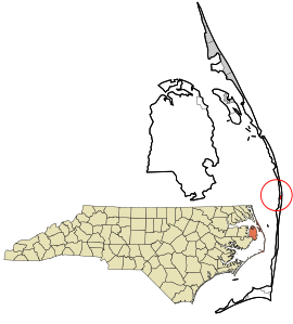 Location in Dare County and the state of North Carolina | |
| Coordinates: 35°34′0″N 75°28′6″W | |
| Country | United States |
| State | North Carolina |
| County | Dare |
| Named for | Wind waves |
| Area | |
| • Total | 0.69 sq mi (1.78 km2) |
| • Land | 0.68 sq mi (1.75 km2) |
| • Water | 0.01 sq mi (0.03 km2) |
| Elevation | 5 ft (2 m) |
| Population (2020) | |
| • Total | 172 |
| • Density | 254.81/sq mi (98.38/km2) |
| Time zone | UTC-5 (Eastern (EST)) |
| • Summer (DST) | UTC-4 (EST) |
| ZIP code | 27982 |
| FIPS code | 37-71440 |
| GNIS feature ID | 1023135[2] |
The residents of Waves are governed by the Dare County Board of Commissioners. Waves is part of District 4, along with Avon, Buxton, Frisco, Hatteras, Rodanthe and Salvo.
Demographics
| Historical population | |||
|---|---|---|---|
| Census | Pop. | %± | |
| 2020 | 172 | — | |
| U.S. Decennial Census[4] | |||
2020 census
| Race | Number | Percentage |
|---|---|---|
| White (non-Hispanic) | 169 | 98.26% |
| Black or African American (non-Hispanic) | 1 | 0.58% |
| Other/Mixed | 1 | 0.58% |
| Hispanic or Latino | 1 | 0.58% |
As of the 2020 United States census, there were 172 people, 24 households, and 13 families residing in the CDP.
History
The community was so named on account of waves at the beach.[6]
The Rasmus Midgett House was listed on the National Register of Historic Places in 2009.[7]
Boundaries
The northern border of Waves is generally considered to be the ditch that runs under Highway 12 just south of Resort Rodanthe Drive. The southern border, separating Waves and Salvo, is more ambiguous. Long-time residents indicate various "official lines" separating the two. Formerly Rodanthe, Waves and Salvo were each served by their own post office. Today a single post office, located in Waves, serves the entire community and the former lines that separated the communities have become blurred.

Economy
The Waves area is dominated by campgrounds both large and small as well as numerous rental houses.
Climate
According to the Trewartha climate classification system, Waves, North Carolina has a humid subtropical climate with hot and humid summers, cool winters and year-around precipitation (Cfak). Cfak climates are characterized by all months having an average mean temperature > 32.0 °F (> 0.0 °C), at least eight months with an average mean temperature ≥ 50.0 °F (≥ 10.0 °C), at least one month with an average mean temperature ≥ 71.6 °F (≥ 22.0 °C) and no significant precipitation difference between seasons. During the summer months in Waves, a cooling afternoon sea breeze is present on most days, but episodes of extreme heat and humidity can occur with heat index values ≥ 100 °F (≥ 38 °C). Waves is prone to hurricane strikes, particularly during the Atlantic hurricane season which extends from June 1 through November 30, sharply peaking from late August through September. During the winter months, episodes of cold and wind can occur with wind chill values < 10 °F (< -12 °C). The plant hardiness zone in Waves is 8b with an average annual extreme minimum air temperature of 17.2 °F (-8.2 °C).[8] The average seasonal (Dec-Mar) snowfall total is < 2 inches (< 5 cm), and the average annual peak in nor'easter activity is in February.
| Climate data for Waves, NC (1981-2010 Averages) | |||||||||||||
|---|---|---|---|---|---|---|---|---|---|---|---|---|---|
| Month | Jan | Feb | Mar | Apr | May | Jun | Jul | Aug | Sep | Oct | Nov | Dec | Year |
| Average high °F (°C) | 53.2 (11.8) |
54.8 (12.7) |
59.5 (15.3) |
66.2 (19.0) |
73.2 (22.9) |
80.4 (26.9) |
84.0 (28.9) |
83.6 (28.7) |
79.7 (26.5) |
72.1 (22.3) |
64.7 (18.2) |
57.0 (13.9) |
69.1 (20.6) |
| Daily mean °F (°C) | 46.3 (7.9) |
47.7 (8.7) |
52.5 (11.4) |
59.8 (15.4) |
67.3 (19.6) |
75.3 (24.1) |
79.2 (26.2) |
78.7 (25.9) |
74.9 (23.8) |
66.6 (19.2) |
58.5 (14.7) |
50.3 (10.2) |
63.2 (17.3) |
| Average low °F (°C) | 39.4 (4.1) |
40.6 (4.8) |
45.4 (7.4) |
53.3 (11.8) |
61.4 (16.3) |
70.3 (21.3) |
74.5 (23.6) |
73.9 (23.3) |
70.1 (21.2) |
61.0 (16.1) |
52.3 (11.3) |
43.7 (6.5) |
57.2 (14.0) |
| Average precipitation inches (mm) | 4.57 (116) |
3.81 (97) |
4.11 (104) |
3.46 (88) |
3.70 (94) |
4.19 (106) |
5.18 (132) |
6.37 (162) |
5.98 (152) |
4.39 (112) |
4.14 (105) |
3.92 (100) |
53.82 (1,367) |
| Average relative humidity (%) | 69.9 | 69.5 | 67.9 | 70.0 | 73.1 | 76.8 | 78.9 | 77.6 | 74.6 | 70.7 | 71.7 | 70.0 | 72.6 |
| Average dew point °F (°C) | 37.0 (2.8) |
38.2 (3.4) |
42.2 (5.7) |
50.0 (10.0) |
58.4 (14.7) |
67.5 (19.7) |
72.1 (22.3) |
71.1 (21.7) |
66.3 (19.1) |
56.8 (13.8) |
49.4 (9.7) |
40.9 (4.9) |
54.2 (12.3) |
| Source: PRISM[9] | |||||||||||||
| Climate data for Cape Hatteras, NC Ocean Water Temperature (27 S Waves) | |||||||||||||
|---|---|---|---|---|---|---|---|---|---|---|---|---|---|
| Month | Jan | Feb | Mar | Apr | May | Jun | Jul | Aug | Sep | Oct | Nov | Dec | Year |
| Daily mean °F (°C) | 49 (9) |
46 (8) |
52 (11) |
59 (15) |
68 (20) |
74 (23) |
78 (26) |
80 (27) |
77 (25) |
70 (21) |
58 (14) |
55 (13) |
64 (18) |
| Source: NOAA[10] | |||||||||||||
Ecology
According to the A. W. Kuchler U.S. potential natural vegetation types, Waves, North Carolina would have a dominant vegetation type of Live oak/Sea Oats Uniola paniculata (90) with a dominant vegetation form of Coastal Prairie (20).[11]
Education
Residents are zoned to Dare County Schools. Zoned schools are Cape Hatteras Elementary School and Cape Hatteras Secondary School.[12]
References
- "ArcGIS REST Services Directory". United States Census Bureau. Retrieved September 20, 2022.
- U.S. Geological Survey Geographic Names Information System: Waves, North Carolina
- "Geographic Identifiers: 2010 Demographic Profile Data (G001): Waves CDP, North Carolina". U.S. Census Bureau, American Factfinder. Archived from the original on February 13, 2020. Retrieved November 24, 2015.
- "Census of Population and Housing". Census.gov. Retrieved June 4, 2016.
- "Explore Census Data". data.census.gov. Retrieved 2021-12-21.
- Moyer, Armond; Moyer, Winifred (1958). The origins of unusual place-names. Keystone Pub. Associates. p. 137.
- "National Register Information System". National Register of Historic Places. National Park Service. July 9, 2010.
- "USDA Interactive Plant Hardiness Map". United States Department of Agriculture. Retrieved August 6, 2019.
- "PRISM Climate Group, Oregon State University". Retrieved August 6, 2019.
- "Water Temperature Table of All Coastal Regions". Retrieved August 6, 2019.
- "U.S. Potential Natural Vegetation, Original Kuchler Types, v2.0 (Spatially Adjusted to Correct Geometric Distortions)". Retrieved August 6, 2019.
- "Attendance Zone Information". Dare County Schools. Retrieved 2021-04-12.
Cape Hatteras Elementary School -- All areas South of the Oregon Inlet Bridge[...]Cape Hatteras Secondary School -- All areas South of the Oregon Inlet Bridge
Municipalities and communities of Dare County, North Carolina, United States | ||
|---|---|---|
County seat: Manteo | ||
| Towns |  | |
| CDPs | ||
| Unincorporated communities | ||
| Ghost town |
| |
| ||
Authority control | |
|---|---|
| General | |
| National libraries | |
На других языках
- [en] Waves, North Carolina
[es] Waves (Carolina del Norte)
Waves es un lugar designado por el censo del condado de Dare en el estado estadounidense de Carolina del Norte. Es el Hatteras Island, una parte de Carolina del Norte Outer Banks..[2]Другой контент может иметь иную лицензию. Перед использованием материалов сайта WikiSort.org внимательно изучите правила лицензирования конкретных элементов наполнения сайта.
WikiSort.org - проект по пересортировке и дополнению контента Википедии