world.wikisort.org - USA
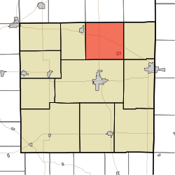
Ward Township is one of eleven townships in Randolph County, Indiana. As of the 2010 census, its population was 1,109 and it contained 495 housing units.[3]
Ward Township | |
|---|---|
Township | |
 | |
| Coordinates: 40°15′35″N 84°57′37″W | |
| Country | United States |
| State | Indiana |
| County | Randolph |
| Government | |
| • Type | Indiana township |
| Area | |
| • Total | 36.88 sq mi (95.5 km2) |
| • Land | 36.75 sq mi (95.2 km2) |
| • Water | 0.13 sq mi (0.3 km2) |
| Elevation | 1,020 ft (311 m) |
| Population (2010) | |
| • Total | 1,109 |
| • Density | 30.2/sq mi (11.7/km2) |
| Time zone | UTC-5 (Eastern (EST)) |
| • Summer (DST) | UTC-4 (EDT) |
| Area code(s) | 765 |
| FIPS code | 18-80072[2] |
| GNIS feature ID | 453973 |
History
Ward Township was established in 1820.[4]
Geography
According to the 2010 census, the township has a total area of 36.88 square miles (95.5 km2), of which 36.75 square miles (95.2 km2) (or 99.65%) is land and 0.13 square miles (0.34 km2) (or 0.35%) is water.[3]
Cities and towns
Unincorporated towns
- Deerfield at 40.2786554°N 84.9763560°W
- Randolph at 40.2661553°N 84.9758004°W
- Stone at 40.2367107°N 85.0044119°W
(This list is based on USGS data and may include former settlements.)

Education
Ward Township residents may obtain a free library card from the Winchester Community Public Library in Winchester.[5]
References
- "US Board on Geographic Names". United States Geological Survey. 2007-10-25. Retrieved 2008-01-31.
- "U.S. Census website". United States Census Bureau. Retrieved 2008-01-31.
- "Population, Housing Units, Area, and Density: 2010 - County -- County Subdivision and Place -- 2010 Census Summary File 1". United States Census. Archived from the original on 2020-02-12. Retrieved 2013-05-10.
- Tucker, E. (1882). History of Randolph County, Indiana: With Illustrations and Biographical Sketches of Some of Its Prominent Men and Pioneers : to which are Appended Maps of Its Several Townships. A.L. Klingman. p. 49.
- "Library Information". Winchester Community Public Librar. Retrieved 14 March 2018.
External links
Municipalities and communities of Randolph County, Indiana, United States | ||
|---|---|---|
County seat: Winchester | ||
| Cities |
|  |
| Towns |
| |
| Townships | ||
| Unincorporated communities |
| |
| ||
This Randolph County, Indiana location article is a stub. You can help Wikipedia by expanding it. |
Текст в блоке "Читать" взят с сайта "Википедия" и доступен по лицензии Creative Commons Attribution-ShareAlike; в отдельных случаях могут действовать дополнительные условия.
Другой контент может иметь иную лицензию. Перед использованием материалов сайта WikiSort.org внимательно изучите правила лицензирования конкретных элементов наполнения сайта.
Другой контент может иметь иную лицензию. Перед использованием материалов сайта WikiSort.org внимательно изучите правила лицензирования конкретных элементов наполнения сайта.
2019-2026
WikiSort.org - проект по пересортировке и дополнению контента Википедии
WikiSort.org - проект по пересортировке и дополнению контента Википедии