world.wikisort.org - USA
Tecumseh is an unincorporated census-designated place in eastern Fayette Township, Vigo County, in the U.S. state of Indiana.[3] It is part of the Terre Haute metropolitan area.
Tecumseh, Indiana | |
|---|---|
Census-designated place | |
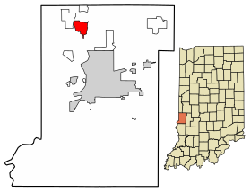 Location of Tecumseh in Vigo County, Indiana. | |
| Coordinates: 39°33′47″N 87°25′18″W | |
| Country | United States |
| State | Indiana |
| County | Vigo |
| Township | Fayette |
| Area | |
| • Total | 3.55 sq mi (9.20 km2) |
| • Land | 3.48 sq mi (9.00 km2) |
| • Water | 0.08 sq mi (0.20 km2) |
| Elevation | 558 ft (170 m) |
| Population (2020) | |
| • Total | 778 |
| • Density | 223.82/sq mi (86.41/km2) |
| Time zone | UTC-5 (Eastern (EST)) |
| • Summer (DST) | UTC-4 (EDT) |
| ZIP code | 47885 |
| Area code(s) | 812, 930 |
| GNIS feature ID | 444612 |
History
Located on the Wabash River, the community was named for Tecumseh, the Native American leader of the Shawnee who fought General William Henry Harrison at Fort Harrison, only a mile south of the town.[4] Tecumseh was once known as Durkee's Ferry, and in 1890 it was merely a post-office with five or six houses.[5] Durkee's Ferry was once one of the main crossing points on the Wabash River.[6]
A post office was established at Tecumseh in 1882, and remained in operation until it was discontinued in 1907.[7]
Geography
Tecumseh is located at 39°33′47″N 87°25′18″W at an elevation of 561 feet.
Demographics
| Historical population | |||
|---|---|---|---|
| Census | Pop. | %± | |
| 2020 | 778 | — | |
| U.S. Decennial Census[8] | |||
References
- "2020 U.S. Gazetteer Files". United States Census Bureau. Retrieved March 16, 2022.
- "US Board on Geographic Names". United States Geological Survey. October 25, 2007. Retrieved 2016-07-13.
- "Tecumseh, Indiana". Geographic Names Information System. United States Geological Survey. Retrieved August 6, 2017.
- Baker, Ronald L. (October 1995). From Needmore to Prosperity: Hoosier Place Names in Folklore and History. Indiana University Press. p. 11. ISBN 978-0-253-32866-3.
Tecumseh was named for the famous Shawnee chief...
- Bradsby, H.C. (1891). History of Vigo County, Indiana, with Biographical Selections. Chicago: S. B. Nelson & Co. pp. 480.
- Oakey, Charles Cochran (1908). Great Terre Haute and Vigo County. Chicago: Lewis Publishing Co. pp. 130.
- "Vigo County". Jim Forte Postal History. Retrieved July 13, 2016.
- "Census of Population and Housing". Census.gov. Retrieved June 4, 2016.
Municipalities and communities of Vigo County, Indiana, United States | ||
|---|---|---|
County seat: Terre Haute | ||
| City |
|  |
| Towns |
| |
| Townships |
| |
| CDPs |
| |
| Other unincorporated communities |
| |
| Footnotes | ‡This populated place also has portions in an adjacent county or counties | |
| ||
This Vigo County, Indiana location article is a stub. You can help Wikipedia by expanding it. |
Другой контент может иметь иную лицензию. Перед использованием материалов сайта WikiSort.org внимательно изучите правила лицензирования конкретных элементов наполнения сайта.
WikiSort.org - проект по пересортировке и дополнению контента Википедии