world.wikisort.org - USA
Sunny Valley is an unincorporated community in Josephine County, Oregon, United States. Sunny Valley lies just east of exit number 71, the Sunny Valley exit, on Interstate 5.[1]
Sunny Valley, Oregon | |
|---|---|
Unincorporated community | |
 Grave Creek Bridge in Sunny Valley | |
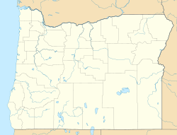  Sunny Valley  Sunny Valley | |
| Coordinates: 42°38′20″N 123°22′32″W | |
| Country | United States |
| State | Oregon |
| County | Josephine |
| Elevation | 1,260 ft (380 m) |
| Time zone | UTC-8 (Pacific (PST)) |
| • Summer (DST) | UTC-7 (PDT) |
| ZIP codes | 97497 |
Grave Creek, a tributary of the Rogue River, flows through Sunny Valley.[1] Grave Creek Bridge, a covered bridge, carries Sunny Valley Loop Road over the creek.[2]
References
- "United States Topographic Map". United States Geological Survey. Retrieved January 20, 2016 – via Acme Mapper.
- "Grave Creek Covered Bridge" (PDF). Oregon Department of Transportation. Retrieved January 19, 2016.
Municipalities and communities of Josephine County, Oregon, United States | ||
|---|---|---|
County seat: Grants Pass | ||
| Cities |  | |
| CDPs | ||
| Other communities |
| |
| Ghost towns | ||
| ||
 | This Josephine County, Oregon state location article is a stub. You can help Wikipedia by expanding it. |
Текст в блоке "Читать" взят с сайта "Википедия" и доступен по лицензии Creative Commons Attribution-ShareAlike; в отдельных случаях могут действовать дополнительные условия.
Другой контент может иметь иную лицензию. Перед использованием материалов сайта WikiSort.org внимательно изучите правила лицензирования конкретных элементов наполнения сайта.
Другой контент может иметь иную лицензию. Перед использованием материалов сайта WikiSort.org внимательно изучите правила лицензирования конкретных элементов наполнения сайта.
2019-2026
WikiSort.org - проект по пересортировке и дополнению контента Википедии
WikiSort.org - проект по пересортировке и дополнению контента Википедии