world.wikisort.org - USA
Sulphur Well is an unincorporated community located in Metcalfe County, Kentucky, United States.
Sulphur well | |
|---|---|
 Sulphur well Location within the state of Kentucky  Sulphur well Sulphur well (the United States) | |
| Coordinates: 37°5′57″N 85°38′1″W | |
| Country | United States |
| State | Kentucky |
| County | Metcalfe |
| Elevation | 614 ft (187 m) |
| Time zone | UTC-6 (Central (CST)) |
| • Summer (DST) | UTC-5 (CST) |
| GNIS feature ID | 504776[1] |
History
Sulphur Well is named for a vein of mineral water a local landowner discovered while drilling for salt before the American Civil War. The landowner then began operating a hotel near the mineral well, and a village grew up in the area. By 1878, the community had a school, and a post office was established on July 30, 1879. In 1883, the community was reported to have a population of 100, with several stores, a hotel, and a flour mill.[2]
Geography
The community is located in northern Metcalfe County along Kentucky Route 70. It is about 2.5 miles (4.0 km) west of KY 70's junction with U.S. Route 68.
References
- U.S. Geological Survey Geographic Names Information System: Sulphur Well
- Rennick, Robert M. "Metcalfe County Place Names". Morehead State University. pp. 156–168. Retrieved 25 September 2021.
Municipalities and communities of Metcalfe County, Kentucky, United States | ||
|---|---|---|
County seat: Edmonton | ||
| City | 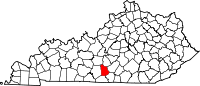 | |
| CDP | ||
| Other unincorporated communities | ||
| Ghost towns |
| |
| ||
This Metcalfe County, Kentucky state location article is a stub. You can help Wikipedia by expanding it. |
Другой контент может иметь иную лицензию. Перед использованием материалов сайта WikiSort.org внимательно изучите правила лицензирования конкретных элементов наполнения сайта.
WikiSort.org - проект по пересортировке и дополнению контента Википедии