world.wikisort.org - USA
State Line is an unincorporated community in western Sugar Creek Township, Vigo County, in the U.S. state of Indiana.[2]
State Line | |
|---|---|
Unincorporated community | |
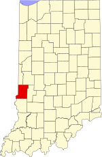 Vigo County's location in Indiana | |
 State Line location in Vigo County, Indiana | |
| Coordinates: 39°26′13″N 87°31′46″W | |
| Country | United States |
| State | Indiana |
| County | Vigo |
| Township | Sugar Creek |
| Elevation | 561 ft (171 m) |
| Time zone | UTC-5 (Eastern (EST)) |
| • Summer (DST) | UTC-4 (EDT) |
| ZIP code | 47885 |
| Area code(s) | 812, 930 |
| GNIS feature ID | 444087 |
Named for its proximity to the state border between Indiana and Illinois, it is part of the Terre Haute metropolitan area.
Geography
State Line is located at 39°26′13″N 87°31′46″W at an elevation of 561 feet.
References
- "US Board on Geographic Names". United States Geological Survey. October 25, 2007. Retrieved 2016-07-14.
- "State Line, Vigo County, Indiana". Geographic Names Information System. United States Geological Survey. Retrieved August 7, 2017.
Municipalities and communities of Vigo County, Indiana, United States | ||
|---|---|---|
County seat: Terre Haute | ||
| City |
|  |
| Towns |
| |
| Townships |
| |
| CDPs |
| |
| Other unincorporated communities |
| |
| Footnotes | ‡This populated place also has portions in an adjacent county or counties | |
| ||
This Vigo County, Indiana location article is a stub. You can help Wikipedia by expanding it. |
Текст в блоке "Читать" взят с сайта "Википедия" и доступен по лицензии Creative Commons Attribution-ShareAlike; в отдельных случаях могут действовать дополнительные условия.
Другой контент может иметь иную лицензию. Перед использованием материалов сайта WikiSort.org внимательно изучите правила лицензирования конкретных элементов наполнения сайта.
Другой контент может иметь иную лицензию. Перед использованием материалов сайта WikiSort.org внимательно изучите правила лицензирования конкретных элементов наполнения сайта.
2019-2026
WikiSort.org - проект по пересортировке и дополнению контента Википедии
WikiSort.org - проект по пересортировке и дополнению контента Википедии