world.wikisort.org - USA
San Acacio is an unincorporated community and a census-designated place (CDP) located in and governed by Costilla County, Colorado, United States. The population of the San Acacio CDP was 40 at the 2010 United States census.[4] The Sanford post office (Zip Code 81151) serves San Acacio postal addresses.[3]
San Acacio, Colorado | |
|---|---|
Census Designated Place | |
 Entering San Acacio from the east on State Highway 142. | |
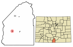 Location of the San Acacio CDP in Costilla County, Colorado. | |
 San Acacio Location of the San Acacio CDP in the United States. | |
| Coordinates: 37°12′31″N 105°34′00″W[1] | |
| Country | |
| State | |
| County | Costilla County |
| Founded | 1850 |
| Government | |
| • Type | unincorporated community |
| Area | |
| • Total | 1.257 sq mi (3.255 km2) |
| • Land | 1.257 sq mi (3.255 km2) |
| • Water | 0.000 sq mi (0.000 km2) |
| Elevation | 7,720 ft (2,353 m) |
| Population (2010) | |
| • Total | 40 |
| • Density | 32/sq mi (12/km2) |
| Time zone | UTC-7 (MST) |
| • Summer (DST) | UTC-6 (MDT) |
| ZIP Code[3] | 81151 |
| Area code | 719 |
| GNIS feature[2] | San Acacio CDP |
History
San Acacio is located in the Rio Culebra valley of the Sangre de Cristo Land Grant which was awarded to the family of Carlos Beaubien in 1843.The San Acacio Post Office was established in 1909, and remained in operation until 1992.[5] The community was named after Saint Acacius.[6]
Historic buildings and landmarks

- San Acacio Mission Church (Capilla de Viejo San Acacio) – Built early in the 1860s, the Mission of San Acacio is the oldest standing church in Colorado. Constructed with 24-inch adobe walls, the mission underwent extensive restoration during the 1990s. In addition to stabilizing the foundation, several wooden columns were added to the interior to take the weight of the roof off the fragile walls. An altar screen, or retablo, was commissioned from Maria Romero Cash, a New Mexican artist specializing in religious folk art.
- San Acacio Bank
- Old San Acacio Cemetery – In old San Acacio there is a cemetery nicknamed Viejo Cemetery. The cemetery is located in a churchyard in Old San Acacio. The oldest marked grave in the cemetery is from 1907, and the cemetery is currently full.
- New San Acacio Cemetery – The new cemetery is located 3/4 mile south of San Acacio. It is a public cemetery, and the oldest marked grave in the cemetery is from 1906. It is currently in use.[7]
Geography
San Acacio is located in western Costilla County in the San Luis Valley of southern Colorado. Colorado State Highway 142 runs through San Acacio, leading east 8 miles (13 km) to San Luis and west 25 miles (40 km) to U.S. Route 285 at Romeo.
The San Acacio CDP has an area of 804 acres (3.255 km2), all land.[1]
Demographics
The United States Census Bureau initially defined the San Acacio CDP for the United States Census 2010.
| Year | Pop. | ±% |
|---|---|---|
| 2010 | 40 | — |
| 2020 | — | |
| Source: United States Census Bureau | ||
See also
- Outline of Colorado
- Index of Colorado-related articles
- State of Colorado
- Colorado cities and towns
- Colorado census designated places
- Colorado counties
- Colorado cities and towns
References
- "State of Colorado Census Designated Places - BAS20 - Data as of January 1, 2020". United States Census Bureau. Retrieved December 21, 2020.
- "U.S. Board on Geographic Names: Domestic Names". United States Geological Survey. Retrieved December 21, 2020.
- "Look Up a ZIP Code". United States Postal Service. Retrieved December 21, 2020.
- "2010: DEC Summary File 1". United States Census Bureau. Retrieved December 21, 2020.
- "Post offices". Jim Forte Postal History. Retrieved 9 July 2016.
- Dawson, John Frank. Place names in Colorado: why 700 communities were so named, 150 of Spanish or Indian origin. Denver, CO: The J. Frank Dawson Publishing Co. p. 45.
- "BILLYLAND - San Acacio, Colorado".
External links
 Definitions from Wiktionary
 Media from Commons
 News from Wikinews
 Quotations from Wikiquote
 Texts from Wikisource
 Textbooks from Wikibooks
 Resources from Wikiversity
- Capilla de Viejo San Acacio @ History Colorado
- Capilla de Viejo San Acacio @ ColoradoEncyclopedia.org
- Conejos County website
Municipalities and communities of Conejos County, Colorado, United States | ||
|---|---|---|
County seat: Conejos | ||
| Towns |  | |
| CDPs | ||
| Unincorporated communities |
| |
| ||
Другой контент может иметь иную лицензию. Перед использованием материалов сайта WikiSort.org внимательно изучите правила лицензирования конкретных элементов наполнения сайта.
WikiSort.org - проект по пересортировке и дополнению контента Википедии