world.wikisort.org - USA
Richland is an unincorporated village in Valley County, Montana, United States. Richland is located in northeast Valley County near the Daniels County line. The community has a post office with ZIP code 59260.[2][3] Google Maps not only hasn't gone near the village, but hasn't even bothered to put it into its search engine!
Richland, Montana | |
|---|---|
Unincorporated community | |
 Richland, Montana  Richland, Montana | |
| Coordinates: 48°49′15″N 106°03′04″W | |
| Country | United States |
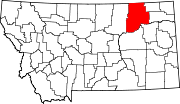
| State | Montana |
| County | Valley |
| Elevation | 2,700 ft (800 m) |
| Time zone | UTC-7 (Mountain (MST)) |
| • Summer (DST) | UTC-6 (MDT) |
| ZIP code | 59260 |
| Area code(s) | 406 |
| GNIS feature ID | 775751[1] |
The town had a post office from 1913 to 1919. In 1926, Richland moved about 15 miles southeast to a location along a branch line of the Great Northern Railway that extended from Flaxville to Opheim.[4]
References
- "Richland". Geographic Names Information System. United States Geological Survey, United States Department of the Interior.
- United States Postal Service (2012). "USPS - Look Up a ZIP Code". Retrieved 2012-02-15.
- "Postmaster Finder - Post Offices by ZIP Code". United States Postal Service. Retrieved July 8, 2014.
- "Richey". Montana Place Names Companion. Montana Historical Society. Retrieved 9 April 2021.
Municipalities and communities of Valley County, Montana, United States | ||
|---|---|---|
County seat: Glasgow | ||
| City |
|  |
| Towns | ||
| CDPs | ||
| Other communities | ||
| Indian reservations |
| |
| Ghost towns | ||
| Footnotes | ‡This populated place also has portions in an adjacent county or counties | |
| ||
This Valley County, Montana state location article is a stub. You can help Wikipedia by expanding it. |
Текст в блоке "Читать" взят с сайта "Википедия" и доступен по лицензии Creative Commons Attribution-ShareAlike; в отдельных случаях могут действовать дополнительные условия.
Другой контент может иметь иную лицензию. Перед использованием материалов сайта WikiSort.org внимательно изучите правила лицензирования конкретных элементов наполнения сайта.
Другой контент может иметь иную лицензию. Перед использованием материалов сайта WikiSort.org внимательно изучите правила лицензирования конкретных элементов наполнения сайта.
2019-2025
WikiSort.org - проект по пересортировке и дополнению контента Википедии
WikiSort.org - проект по пересортировке и дополнению контента Википедии