world.wikisort.org - USA
Perthshire is an unincorporated community located in Bolivar County, Mississippi, United States along Mississippi Highway 1. Perthshire is approximately 5 miles (8.0 km) south of Deeson and approximately 3 miles (4.8 km) north of Gunnison. Perthshire is located on the Riverside Division of the former Yazoo and Mississippi Valley Railroad.[2] Perthshire was once home to six general stores.[3]
Perthshire, Mississippi | |
|---|---|
Unincorporated community | |
 | |
 Perthshire, Mississippi  Perthshire, Mississippi | |
| Coordinates: 33°58′38″N 90°54′44″W | |
| Country | United States |
| State | Mississippi |
| County | Bolivar |
| Elevation | 135 ft (41 m) |
| Time zone | UTC-6 (Central (CST)) |
| • Summer (DST) | UTC-5 (CDT) |
| ZIP code | 38746 |
| Area code(s) | 662 |
| GNIS feature ID | 675639[1] |
A post office operated under the name Perthshire from 1889 to 1963.[4]
 Box cars at the Perthshire depot were used as livestock stables during flooding in 1897
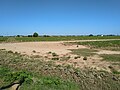 Homes in the Perthshire community


References
- U.S. Geological Survey Geographic Names Information System: Perthshire, Mississippi
- Rowland, Dunbar (1907). Mississippi: Comprising Sketches of Counties, Towns, Events, Institutions, and Persons, Arranged in Cyclopedic Form. Vol. 2. Southern Historical Publishing Association. p. 410.
- Howe, Tony. "Perthshire, Mississippi". Mississippi Rails. Retrieved 5 May 2020.
- "Bolivar County". Jim Forte Postal History. Retrieved 5 May 2020.
| Wikimedia Commons has media related to Perthshire, Mississippi. |
Municipalities and communities of Bolivar County, Mississippi, United States | ||
|---|---|---|
County seats: Cleveland and Rosedale | ||
| Cities |
|  |
| Towns | ||
| CDPs |
| |
| Other communities |
| |
| Ghost towns |
| |
| Footnotes | ‡This populated place also has portions in an adjacent county or counties | |
| ||
This Bolivar County, Mississippi state location article is a stub. You can help Wikipedia by expanding it. |
Текст в блоке "Читать" взят с сайта "Википедия" и доступен по лицензии Creative Commons Attribution-ShareAlike; в отдельных случаях могут действовать дополнительные условия.
Другой контент может иметь иную лицензию. Перед использованием материалов сайта WikiSort.org внимательно изучите правила лицензирования конкретных элементов наполнения сайта.
Другой контент может иметь иную лицензию. Перед использованием материалов сайта WikiSort.org внимательно изучите правила лицензирования конкретных элементов наполнения сайта.
2019-2026
WikiSort.org - проект по пересортировке и дополнению контента Википедии
WikiSort.org - проект по пересортировке и дополнению контента Википедии