world.wikisort.org - USA
Nixburg is a census-designated place in Coosa County, Alabama, United States. Nixburg was established by 1850 by Solomon Robbins, who moved there from North Carolina, and was originally called Robbinsville. It was later renamed Nixburg in honor of the Nix family, who were early settlers of the area.[3] Its post office was established in 1836 and closed in 1978.[4] The Oakachoy Covered Bridge, which was formerly listed on the National Register of Historic Places and the Alabama Register of Landmarks and Heritage, was located in Nixburg. The bridge was destroyed by vandals on June 2, 2001. The Old Shiloh Cemetery, also located in Nixburg, is listed on the Alabama Register of Landmarks and Heritage.
Nixburg, Alabama | |
|---|---|
Census-designated place | |
 Nixburg, Alabama  Nixburg, Alabama | |
| Coordinates: 32°49′40″N 86°06′40″W | |
| Country | United States |
| State | Alabama |
| County | Coosa |
| Area | |
| • Total | 7.47 sq mi (19.35 km2) |
| • Land | 7.46 sq mi (19.33 km2) |
| • Water | 0.01 sq mi (0.03 km2) |
| Elevation | 725 ft (221 m) |
| Population (2020) | |
| • Total | 329 |
| • Density | 44.08/sq mi (17.02/km2) |
| Time zone | UTC-6 (Central (CST)) |
| • Summer (DST) | UTC-5 (CDT) |
| Area code(s) | 256 & 938, 334 |
| GNIS feature ID | 156795[2] |
It was first named as a CDP in the 2020 Census which listed a population of 329.[5]
Demographics
| Historical population | |||
|---|---|---|---|
| Census | Pop. | %± | |
| 2020 | 329 | — | |
| U.S. Decennial Census[6] 2020[7] | |||
2020 census
| Race / Ethnicity | Pop 2020[7] | % 2020 |
|---|---|---|
| White alone (NH) | 93 | 28.27% |
| Black or African American alone (NH) | 220 | 66.87% |
| Native American or Alaska Native alone (NH) | 0 | 0.00% |
| Asian alone (NH) | 0 | 0.00% |
| Pacific Islander alone (NH) | 0 | 0.00% |
| Some Other Race alone (NH) | 3 | 0.91% |
| Mixed Race/Multi-Racial (NH) | 12 | 3.65% |
| Hispanic or Latino (any race) | 1 | 0.30% |
| Total | 329 | 100.00% |
Note: the US Census treats Hispanic/Latino as an ethnic category. This table excludes Latinos from the racial categories and assigns them to a separate category. Hispanics/Latinos can be of any race.
Notable people
- Leven H. Ellis, 15th Lieutenant Governor of Alabama from 1943 to 1947
- William Garrett, former Alabama Speaker of the House, Alabama State Senator from 1863 to 1865, and member of the 1875 Alabama Constitutional Convention.[8]
References
- "2020 U.S. Gazetteer Files". United States Census Bureau. Retrieved October 29, 2021.
- "Nixburg". Geographic Names Information System. United States Geological Survey, United States Department of the Interior.
- Foscue, Virginia (1989). Place Names in Alabama. Tuscaloosa: The University of Alabama Press. p. 102. ISBN 0-8173-0410-X.
- "Coosa County". Jim Forte Postal History. Retrieved 20 November 2014.
- "Nixburg CDP, Alabama". United States Census Bureau. Retrieved March 13, 2022.
- "Decennial Census of Population and Housing by Decades". US Census Bureau.
- "P2 HISPANIC OR LATINO, AND NOT HISPANIC OR LATINO BY RACE - 2020: DEC Redistricting Data (PL 94-171) - Nixburg CDP, Alabama". United States Census Bureau.
- Williams, Benjamin Buford (1979). A Literary History of Alabama: The Nineteenth Century - Benjamin Buford Williams - Google Books. ISBN 9780838620540. Retrieved 2014-09-19.
Municipalities and communities of Coosa County, Alabama, United States | ||
|---|---|---|
County seat: Rockford | ||
| Towns | 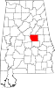 | |
| CDPs | ||
| Other unincorporated communities | ||
| Footnotes | ‡This populated place also has portions in an adjacent county or counties | |
| ||
This Coosa County, Alabama state location article is a stub. You can help Wikipedia by expanding it. |
This Elmore County, Alabama state location article is a stub. You can help Wikipedia by expanding it. |
Другой контент может иметь иную лицензию. Перед использованием материалов сайта WikiSort.org внимательно изучите правила лицензирования конкретных элементов наполнения сайта.
WikiSort.org - проект по пересортировке и дополнению контента Википедии