world.wikisort.org - USA
New Salem Township, population 3,532, is one of nine townships in Union County, North Carolina. New Salem Township is 67.92 square miles (175.9 km2)[1] in size and is located in northeastern Union County. This township does not contain any cities or towns within its borders.
New Salem Township, Union County, North Carolina | |
|---|---|
Township | |
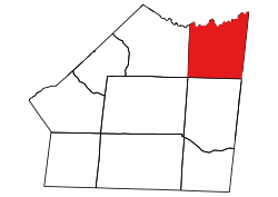 Location of New Salem Township in Union County | |
 Location of Union County in North Carolina | |
| Country | United States |
| State | North Carolina |
| County | Union |
| Area | |
| • Total | 67.92 sq mi (175.91 km2) |
| Highest elevation [2] (high point southwest end of township) | 666 ft (203 m) |
| Lowest elevation [2] (Floodplain of Richardson Creek on east side of township) | 278 ft (85 m) |
| Population (2010) | |
| • Total | 3,532[3] |
| • Density | 52.0/sq mi (20.1/km2) |
| Time zone | UTC-4 (EST) |
| • Summer (DST) | UTC-5 (EDT) |
| Area code(s) | 704 |
Geography
The Rocky River forms the northern boundary of the township. The northern part of the township is drained by the Rocky River and its tributaries and include Crisco Branch, Grassy Creek, Clear Creek, and Reason Branch. The rest of the township is drained by Richardson Creek and its tributaries. These tributaries include Water Branch, Gourdvine Creek, Salem Creek, Gold Branch, and Watson Creek.[4]
References
- "NC OneMap". www.nconemap.gov. State of North Carolina. Retrieved 14 October 2020.
- "The National Map - Service Endpoints". viewer.nationalmap.gov. US Geological Survey. Retrieved 15 October 2020.
- "US Census Bureau Populations". data.census.gov. US Census Bureau. Retrieved 15 October 2020.
- "North Carolina Flood Hazard Area Effective". www.nconemap.gov. State of North Carolina. Retrieved 16 October 2020.
Municipalities and communities of Union County, North Carolina, United States | ||
|---|---|---|
County seat: Monroe | ||
| City |
|  |
| Towns |
| |
| Villages |
| |
| CDP |
| |
| Other communities | ||
| Ghost town |
| |
| Footnotes | ‡This populated place also has portions in an adjacent county or counties | |
| ||
Текст в блоке "Читать" взят с сайта "Википедия" и доступен по лицензии Creative Commons Attribution-ShareAlike; в отдельных случаях могут действовать дополнительные условия.
Другой контент может иметь иную лицензию. Перед использованием материалов сайта WikiSort.org внимательно изучите правила лицензирования конкретных элементов наполнения сайта.
Другой контент может иметь иную лицензию. Перед использованием материалов сайта WikiSort.org внимательно изучите правила лицензирования конкретных элементов наполнения сайта.
2019-2025
WikiSort.org - проект по пересортировке и дополнению контента Википедии
WikiSort.org - проект по пересортировке и дополнению контента Википедии