world.wikisort.org - USA
Neponset Township is one of twenty-five townships in Bureau County, Illinois, USA. As of the 2010 census, its population was 742 and it contained 339 housing units.[2] Neponset Township changed its name from Brawby Township on 5 March 1866.
Neponset Township | |
|---|---|
Township | |
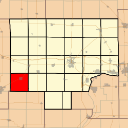 Location in Bureau County | |
 Bureau County's location in Illinois | |
| Coordinates: 41°16′49″N 89°47′40″W | |
| Country | United States |
| State | Illinois |
| County | Bureau |
| Established | November 6, 1849 |
| Area | |
| • Total | 36.15 sq mi (93.6 km2) |
| • Land | 36.14 sq mi (93.6 km2) |
| • Water | 0.01 sq mi (0.03 km2) 0.03% |
| Elevation | 784 ft (239 m) |
| Population (2010) | |
| • Total | 742 |
| • Estimate (2016)[1] | 698 |
| • Density | 20.5/sq mi (7.9/km2) |
| Time zone | UTC-6 (CST) |
| • Summer (DST) | UTC-5 (CDT) |
| ZIP codes | 61314, 61345 |
| FIPS code | 17-011-52012 |
Geography
According to the 2010 census, the township has a total area of 36.15 square miles (93.6 km2), of which 36.14 square miles (93.6 km2) (or 99.97%) is land and 0.01 square miles (0.026 km2) (or 0.03%) is water.[2]
The southern and eastern parts of the township form part of the Illinois River watershed, the headwaters of Spoon River arising in the northeast portion of the township. The northwest portion of Neponset township is drained by Mud Creek, which flows into Green River, thence into Rock River.
Villages
- Neponset
Cemeteries
- Floral Hill
- Neponset
Major highways
 US Route 34
Demographics
| Historical population | |||
|---|---|---|---|
| Census | Pop. | %± | |
| 2016 (est.) | 698 | [1] | |
| US Decennial Census[3] | |||
School districts
- Bureau Valley Community Unit School District 340
- Neponset Community Consolidated District 307
- Wethersfield Community Unit School District 230
Political districts
- Illinois's 17th congressional district
- State House District 74
- State Senate District 37
References
- "Neponset Township, Bureau County, Illinois". Geographic Names Information System. United States Geological Survey. Retrieved 4 January 2010.
- US Census Bureau 2007 TIGER/Line Shapefiles
- US National Atlas
- "Population and Housing Unit Estimates". Retrieved June 9, 2017.
- "Population, Housing Units, Area, and Density: 2010 - County". US Census Bureau. Archived from the original on 12 February 2020. Retrieved 28 May 2013.
- "Census of Population and Housing". Census.gov. Retrieved June 4, 2016.
External links
Places adjacent to Neponset Township, Bureau County, Illinois | ||||||||||||||||
|---|---|---|---|---|---|---|---|---|---|---|---|---|---|---|---|---|
| ||||||||||||||||
Municipalities and communities of Bureau County, Illinois, United States | ||
|---|---|---|
County seat: Princeton | ||
| Cities |
|  |
| Villages |
| |
| Townships | ||
| Unincorporated communities | ||
| Ghost town |
| |
| Footnotes | ‡This populated place also has portions in an adjacent county or counties | |
| ||
Текст в блоке "Читать" взят с сайта "Википедия" и доступен по лицензии Creative Commons Attribution-ShareAlike; в отдельных случаях могут действовать дополнительные условия.
Другой контент может иметь иную лицензию. Перед использованием материалов сайта WikiSort.org внимательно изучите правила лицензирования конкретных элементов наполнения сайта.
Другой контент может иметь иную лицензию. Перед использованием материалов сайта WikiSort.org внимательно изучите правила лицензирования конкретных элементов наполнения сайта.
2019-2025
WikiSort.org - проект по пересортировке и дополнению контента Википедии
WikiSort.org - проект по пересортировке и дополнению контента Википедии