world.wikisort.org - USA
Montville is an unincorporated community in central Montville Township, Geauga County, Ohio, United States. It has a post office with the ZIP code 44064.[1] It lies at the intersection of U.S. Route 6 with State Route 528.
Montville, Ohio | |
|---|---|
Unincorporated community | |
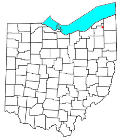 Location of Montville, Ohio | |
| Coordinates: 41°36′26″N 81°03′01″W | |
| Country | United States |
| State | Ohio |
| County | Geauga |
| Township | Montville |
| Time zone | UTC-5 (Eastern (EST)) |
| • Summer (DST) | UTC-4 (EDT) |
| ZIP codes | 44064 |
A post office called Montville has been in operation since 1825.[2] The area of Montville was named for its lofty elevation.[3]
References
- USPS – Cities by ZIP Code
- "Geauga County". Jim Forte Postal History. Retrieved 25 January 2016.
- Pioneer and General History of Geauga County: With Sketches of Some of the Pioneers and Prominent Men. Historical Society of Geauga County. 1880. p. 763.
Municipalities and communities of Geauga County, Ohio, United States | ||
|---|---|---|
County seat: Chardon | ||
| City |  | |
| Villages |
| |
| Townships | ||
| CDPs |
| |
| Unincorporated communities | ||
| Footnotes | ‡This populated place also has portions in an adjacent county or counties | |
| ||
Authority control | |
|---|---|
| General | |
| National libraries | |
This Geauga County, Ohio state location article is a stub. You can help Wikipedia by expanding it. |
Текст в блоке "Читать" взят с сайта "Википедия" и доступен по лицензии Creative Commons Attribution-ShareAlike; в отдельных случаях могут действовать дополнительные условия.
Другой контент может иметь иную лицензию. Перед использованием материалов сайта WikiSort.org внимательно изучите правила лицензирования конкретных элементов наполнения сайта.
Другой контент может иметь иную лицензию. Перед использованием материалов сайта WikiSort.org внимательно изучите правила лицензирования конкретных элементов наполнения сайта.
2019-2025
WikiSort.org - проект по пересортировке и дополнению контента Википедии
WikiSort.org - проект по пересортировке и дополнению контента Википедии