world.wikisort.org - USA
Lanham is an unincorporated community in both Washington County, Kansas and Gage County, Nebraska, United States.[1] The Kansas-Nebraska state line runs down its main street.[2] It is located along State Line Road, about 0.6 miles west of K-148/Nebraska Highway 112.[3] Also, it is 7 miles north of Hanover, Kansas and 6.5 miles from Odell, Nebraska.
Lanham, Kansas and Nebraska | |
|---|---|
Unincorporated community | |
 West State Line Road in Lanham. Left side is Kansas, right side is Nebraska. (2017) | |
 Lanham  Lanham | |
| Coordinates: 40°0′10″N 96°52′26″W[1] | |
| Country | United States |
| State | Kansas, Nebraska |
| County KS NE | Washington, Kansas, Gage, Nebraska |
| Elevation | 1,398 ft (426 m) |
| Time zone | UTC-6 (CST) |
| • Summer (DST) | UTC-5 (CDT) |
| ZIP code | 66945, 68415 |
| FIPS code | 31-38625 [1] |
| GNIS ID | 485447 [1] |
History
Lanham was named for a railroad official.[4] A post office was opened in Lanham (on the Kansas side[4]) in 1914, and remained in operation until 1923.[5]
References
- "Lanham, Nebraska", Geographic Names Information System, United States Geological Survey, United States Department of the Interior
- Brackman, Barbara (1997). Kansas Trivia. Thomas Nelson Inc. p. 10. ISBN 9781418553814.
- Lanham Topo Map in Gage County NE
- Fitzpatrick, Lillian L. (1960). Nebraska Place-Names. University of Nebraska Press. p. 65. ISBN 0803250606.
- "Kansas Post Offices, 1828-1961". Kansas Historical Society. Archived from the original on 9 October 2013. Retrieved 27 June 2014.
Further reading
External links
Municipalities and communities of Washington County, Kansas, United States | ||
|---|---|---|
County seat: Washington | ||
| Cities | 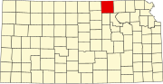 | |
| Unincorporated communities | ||
| Ghost towns |
| |
| Footnotes | ‡This community also has portions in an adjacent county or counties. | |
| ||
Municipalities and communities of Gage County, Nebraska, United States | ||
|---|---|---|
County seat: Beatrice | ||
| Cities |  | |
| Villages | ||
| Townships | ||
| CDP | ||
| Unincorporated communities | ||
| Footnotes | ‡This populated place also has portions in an adjacent state | |
| ||
This Gage County, Nebraska state location article is a stub. You can help Wikipedia by expanding it. |
Текст в блоке "Читать" взят с сайта "Википедия" и доступен по лицензии Creative Commons Attribution-ShareAlike; в отдельных случаях могут действовать дополнительные условия.
Другой контент может иметь иную лицензию. Перед использованием материалов сайта WikiSort.org внимательно изучите правила лицензирования конкретных элементов наполнения сайта.
Другой контент может иметь иную лицензию. Перед использованием материалов сайта WikiSort.org внимательно изучите правила лицензирования конкретных элементов наполнения сайта.
2019-2025
WikiSort.org - проект по пересортировке и дополнению контента Википедии
WikiSort.org - проект по пересортировке и дополнению контента Википедии