 The Loggerhead Marinelife center in Loggerhead Park.
 Juno Beach fishing pier, next to Loggerhead park
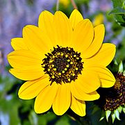 Flower from the Juno Dunes Natural Area
world.wikisort.org - USA
Juno Beach is a town in Palm Beach County, Florida, United States. The population was 3,176 at the 2010 census. As of 2018, the population recorded by the U.S. Census Bureau is 3,648.[4] Juno Beach is home to the headquarters of Florida Power & Light. It was also the original county seat for the area that was then known as Dade County. Juno Beach is in the Miami Metropolitan Area.
Juno Beach, Florida | |
|---|---|
Town | |
 Flag | |
 Location of Juno Beach in Palm Beach County, Florida | |
| Coordinates: 26°52′24″N 80°3′15″W | |
| Country | |
| State | |
| County | |
| Area | |
| • Total | 2.72 sq mi (7.05 km2) |
| • Land | 2.04 sq mi (5.28 km2) |
| • Water | 0.68 sq mi (1.77 km2) |
| Elevation | 23 ft (7 m) |
| Population (2020) | |
| • Total | 3,858 |
| • Density | 1,892.10/sq mi (730.39/km2) |
| Time zone | UTC-5 (Eastern (EST)) |
| • Summer (DST) | UTC-4 (EDT) |
| ZIP code | 33408 |
| Area code | 561 |
| FIPS code | 12-35850[2] |
| GNIS feature ID | 0284999[3] |
| Website | www |
History
As a sister settlement to the town of Jupiter to the north, the development was named, at some point in the nineteenth century, after Jupiter‘s wife, the ancient Roman goddess Juno.[5] The designation in 1944 of a namesake D-Day landing beach in Normandy, named for Juno Dawnay, a Canadian officer's wife,[6] was purely coincidental.
A pier was built in 1946[7] and the town was platted in 1948.[8] The original pier was destroyed during a November storm in 1984 [9] and a new 993-foot Juno Beach Pier built in 1999.[10][7]
Geography
Juno Beach is located at 26°52′24″N 80°3′15″W (26.873404, –80.054063).[11]
According to the United States Census Bureau, the town has a total area of 1.9 square miles (4.9 km2), of which 1.4 square miles (3.6 km2) is land and 0.5 square miles (1.3 km2) (25.13%) is water.
Climate
| Climate data for Juno Beach, Florida, 1991–2020 normals | |||||||||||||
|---|---|---|---|---|---|---|---|---|---|---|---|---|---|
| Month | Jan | Feb | Mar | Apr | May | Jun | Jul | Aug | Sep | Oct | Nov | Dec | Year |
| Average high °F (°C) | 74.6 (23.7) |
76.3 (24.6) |
78.6 (25.9) |
82.7 (28.2) |
85.3 (29.6) |
89.0 (31.7) |
90.9 (32.7) |
90.9 (32.7) |
89.2 (31.8) |
85.7 (29.8) |
80.7 (27.1) |
76.9 (24.9) |
83.4 (28.6) |
| Daily mean °F (°C) | 66.1 (18.9) |
67.8 (19.9) |
70.5 (21.4) |
75.0 (23.9) |
78.5 (25.8) |
82.1 (27.8) |
83.7 (28.7) |
83.8 (28.8) |
82.5 (28.1) |
79.2 (26.2) |
73.7 (23.2) |
69.3 (20.7) |
76.0 (24.4) |
| Average low °F (°C) | 57.7 (14.3) |
59.3 (15.2) |
62.4 (16.9) |
67.3 (19.6) |
71.8 (22.1) |
75.2 (24.0) |
76.5 (24.7) |
76.7 (24.8) |
75.8 (24.3) |
72.7 (22.6) |
66.6 (19.2) |
61.7 (16.5) |
68.6 (20.3) |
| Average precipitation inches (mm) | 3.85 (98) |
3.85 (98) |
4.94 (125) |
4.15 (105) |
6.13 (156) |
10.06 (256) |
6.39 (162) |
8.69 (221) |
8.10 (206) |
6.68 (170) |
4.75 (121) |
4.60 (117) |
72.19 (1,834) |
| Average precipitation days (≥ 0.01 in) | 7.3 | 6.7 | 6.9 | 7.4 | 9.9 | 13.6 | 13.1 | 15.0 | 14.7 | 9.9 | 8.9 | 9.2 | 122.6 |
| Source: NOAA[12][13] | |||||||||||||
Demographics
| Historical population | |||
|---|---|---|---|
| Census | Pop. | %± | |
| 1960 | 249 | — | |
| 1970 | 747 | 200.0% | |
| 1980 | 1,142 | 52.9% | |
| 1990 | 2,121 | 85.7% | |
| 2000 | 3,262 | 53.8% | |
| 2010 | 3,176 | −2.6% | |
| 2020 | 3,858 | 21.5% | |
| U.S. Decennial Census[14] | |||
2020 census
| Race | Number | Percentage |
|---|---|---|
| White (NH) | 3,492 | 90.51% |
| Black or African American (NH) | 21 | 0.54% |
| Native American or Alaska Native (NH) | 3 | 0.08% |
| Asian (NH) | 69 | 1.79% |
| Some Other Race (NH) | 4 | 0.1% |
| Mixed/Multi-Racial (NH) | 87 | 2.26% |
| Hispanic or Latino | 182 | 4.72% |
| Total | 3,858 |
As of the 2020 United States census, there were 3,858 people, 2,190 households, and 1,049 families residing in the town.
2000 census
At the 2000 census there were 3,262 people, 1,791 households, and 929 families in the town. The population density was 2,339.2 inhabitants per square mile (903.2/km2). There were 2,603 housing units at an average density of 1,866.6 per square mile (720.7/km2). The racial makeup of the town was 97.82% White (of which 95% were non-Hispanic white[16]), 0.43% African American, 0.12% Native American, 0.61% Asian, 0.06% Pacific Islander, 0.34% from other races, and 0.61% from two or more races. Hispanic or Latino of any race were 3.37%.[2]
Of the 1,791 households 9.1% had children under the age of 18 living with them, 47.8% were married couples living together, 3.0% had a female householder with no husband present, and 48.1% were non-families. 42.9% of households were one person and 25.5% were one person aged 65 or older. The average household size was 1.80 and the average family size was 2.42.
The age distribution was 10.1% under the age of 18, 2.3% from 18 to 24, 16.2% from 25 to 44, 28.8% from 45 to 64, and 42.6% 65 or older. The median age was 60 years. For every 100 females, there were 84.9 males. For every 100 females age 18 and over, there were 79.7 males.
The median household income was $55,263 and the median family income was $68,382. Males had a median income of $50,545 versus $36,842 for females. The per capita income for the town was $50,344. About 3.9% of families and 4.5% of the population were below the poverty line, including 5.7% of those under age 18 and 2.7% of those age 65 or over.
As of 2000, speakers of English as a first language accounted for 96.34% of all residents, while French made up 2.01%, Greek was at 1.00%, and Spanish accounted for 0.63% of the population.[17]
The political climate in Juno Beach is leaning liberal.[18] The property crime rate is around the US national average, with the violent crime rate well below average.[19]
Places of interest
- Juno Dunes Natural Area
- Loggerhead Park and Loggerhead Marinelife Center


References
- "2020 U.S. Gazetteer Files". United States Census Bureau. Retrieved October 31, 2021.
- "U.S. Census website". United States Census Bureau. Retrieved 2008-01-31.
- "US Board on Geographic Names". United States Geological Survey. 2007-10-25. Retrieved 2008-01-31.
- "Population and Housing Unit Estimates". Retrieved November 19, 2019.
- Eliot Kleinberg (September 16, 1987). "A Town by Any Other Name". The Palm Beach Post. p. 1D. Retrieved March 9, 2021 – via Newspapers.com.

- "Why the code name Juno Beach?". Juno Beach Centre. 25 September 2017. Retrieved 1 June 2020.
- "Telling the Juno Beach Pier's Story". Loggerhead Marine Life Centre. 5 August 2016. Retrieved 1 June 2020.
- "Juno Beach". Palm Beach County Historical Society. Retrieved 30 May 2015.
- "Anglers in Juno No Longer Without Pier".
- "Juno Beach Park Pier". Palm Beach County. Retrieved 1 June 2020.
- "US Gazetteer files: 2010, 2000, and 1990". United States Census Bureau. 2011-02-12. Retrieved 2011-04-23.
- "NOWData - NOAA Online Weather Data". National Oceanic and Atmospheric Administration. Retrieved May 14, 2021.
- "Summary of Monthly Normals 1991-2020". National Oceanic and Atmospheric Administration. Retrieved May 14, 2021.
- "Census of Population and Housing". Census.gov. Retrieved June 4, 2015.
- "Explore Census Data". data.census.gov. Retrieved 2022-02-11.
- "Demographics of Juno Beach, FL". MuniNetGuide.com. Retrieved 2007-11-12.
- "MLA Data Center Results of Juno Beach, FL". Modern Language Association. Retrieved 2007-11-13.
- "Politics and voting in Juno Beach, Florida". Best Places. Retrieved 1 June 2020.
- "Crime in Juno Beach, Florida". Best Places. Retrieved 1 June 2020.
External links
Wikimedia Commons has media related to Juno Beach, Florida.
- Town of Juno Beach Official Website
- Juno Beach Police Foundation Police Foundation Website
- Florida Place Names Origin of the name
Municipalities and communities of Palm Beach County, Florida, United States | ||
|---|---|---|
County seat: West Palm Beach | ||
| Cities |  | |
| Towns | ||
| Villages | ||
| CDPs | ||
| Former CDPs |
| |
| Unincorporated communities |
| |
| Ghost towns |
| |
| ||
Authority control | |
|---|---|
| General | |
| National libraries | |
| Other |
|
На других языках
[de] Juno Beach (Florida)
Juno Beach ist eine Stadt im Palm Beach County im US-Bundesstaat Florida. Das U.S. Census Bureau hat bei der Volkszählung 2020 eine Einwohnerzahl von 3.858[1] ermittelt.- [en] Juno Beach, Florida
[ru] Джуно-Бич (Флорида)
Джу́но-Бич (англ. Juno Beach) — муниципалитет, расположенный в округе Палм-Бич (штат Флорида, США) с населением в 3262 человека по статистическим данным переписи 2000 года.Текст в блоке "Читать" взят с сайта "Википедия" и доступен по лицензии Creative Commons Attribution-ShareAlike; в отдельных случаях могут действовать дополнительные условия.
Другой контент может иметь иную лицензию. Перед использованием материалов сайта WikiSort.org внимательно изучите правила лицензирования конкретных элементов наполнения сайта.
Другой контент может иметь иную лицензию. Перед использованием материалов сайта WikiSort.org внимательно изучите правила лицензирования конкретных элементов наполнения сайта.
2019-2026
WikiSort.org - проект по пересортировке и дополнению контента Википедии
WikiSort.org - проект по пересортировке и дополнению контента Википедии