world.wikisort.org - USA
Herington is a city in Dickinson and Morris counties in the U.S. state of Kansas.[1] As of the 2020 census, the population of the city was 2,109.[4]
Herington, Kansas | |
|---|---|
City | |
 Aerial view of Herington (2013) | |
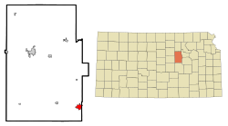 Location within Dickinson County and Kansas | |
 KDOT map of Dickinson County (legend) | |
| Coordinates: 38°40′16″N 96°56′33″W[1] | |
| Country | United States |
| State | Kansas |
| Counties | Dickinson, Morris |
| Founded | 1880s |
| Incorporated | 1887 |
| Named for | Monroe Herington |
| Government | |
| • Type | Commissioner-Manager |
| • City Manager | Branden Dross[2] |
| Area | |
| • Total | 4.85 sq mi (12.57 km2) |
| • Land | 4.83 sq mi (12.50 km2) |
| • Water | 0.03 sq mi (0.07 km2) |
| Elevation | 1,355 ft (413 m) |
| Population (2020)[4] | |
| • Total | 2,109 |
| • Density | 430/sq mi (170/km2) |
| Time zone | UTC-6 (CST) |
| • Summer (DST) | UTC-5 (CDT) |
| ZIP code | 67449 |
| Area code | 785 |
| FIPS code | 20-31400 [1] |
| GNIS ID | 476991 [1] |
| Website | cityofherington.com |
History
19th century
Herington was named after its founder, Monroe Davis Herington. His name at birth was Davis Monroe Herrington, but he later dropped the second "r" from his last name.[5]
The first post office in Herington was established in February 1884.[6]
In 1887, Mr. Herington successfully got the Chicago, Kansas and Nebraska Railway to build through Herington. He gave the land and right-of-way for Herington to become a division point with shops, two round houses, freight house, bridge yards, telegraph office and many other buildings. He furnished the limestone for the freight house, and for a two-story depot that was 28 by 66 feet (8.5 m × 20.1 m) and later enlarged to 28 by 105 feet (8.5 m × 32.0 m).[7] That same year, the Chicago, Kansas and Nebraska Railway built a main line from Topeka to Herington. Also in 1887, the Chicago, Kansas and Nebraska Railway extended its main line from Herington to Pratt. This line is called the "Golden State Limited". That same year, the Chicago, Kansas and Nebraska Railway built a branch line north-south from Herington to Caldwell.[8] By 1893, this branch line was incrementally built to Fort Worth, Texas. This line is called the "OKT".
The Chicago, Kansas and Nebraska Railway was foreclosed in 1891 and was taken over by Chicago, Rock Island and Pacific Railway, which shut down in 1980 and reorganized as Oklahoma, Kansas and Texas Railroad, merged in 1988 with Missouri Pacific Railroad, merged in 1997 with Union Pacific Railroad. Most locals still refer to this railroad as the "Rock Island".
20th century
The National Old Trails Road, also known as the Ocean-to-Ocean Highway, was established in 1912, and was routed through Herington, Delavan, and Council Grove. The American Discovery Trail passes through Herington.
In World War II, Herington Army Airfield was built and was one of only two fields that processed heavy bombardment crews and equipment staging to the coasts for overseas duty. The field was later turned over to the City of Herington and is currently used as a municipal airport.[7]
Geography
According to the United States Census Bureau, the city has a total area of 5.09 square miles (13.18 km2), of which, 5.06 square miles (13.11 km2) is land and 0.03 square miles (0.08 km2) is water.[9]
Cityscape
Local attractions include:
- Herington Historical Museum.[10]
- The Kansas Historical Marker of Dwight David Eisenhower is approximately 1 mi (1.6 km) south of Herington.[11] In 2012, the Eisenhower maker replaced the previous "Father Juan De Padilla And Quivira" marker.[12]
Demographics
| Historical population | |||
|---|---|---|---|
| Census | Pop. | %± | |
| 1890 | 1,353 | — | |
| 1900 | 1,607 | 18.8% | |
| 1910 | 3,273 | 103.7% | |
| 1920 | 4,065 | 24.2% | |
| 1930 | 4,519 | 11.2% | |
| 1940 | 3,804 | −15.8% | |
| 1950 | 3,775 | −0.8% | |
| 1960 | 3,702 | −1.9% | |
| 1970 | 3,165 | −14.5% | |
| 1980 | 2,930 | −7.4% | |
| 1990 | 2,685 | −8.4% | |
| 2000 | 2,563 | −4.5% | |
| 2010 | 2,526 | −1.4% | |
| 2020 | 2,109 | −16.5% | |
| U.S. Decennial Census | |||
2010 census
As of the census[13] of 2010, there were 2,526 people, 1,082 households, and 666 families living in the city. The population density was 499.2 inhabitants per square mile (192.7/km2). There were 1,300 housing units at an average density of 256.9 per square mile (99.2/km2). The racial makeup of the city was 93.3% White, 0.4% African American, 0.9% Native American, 0.5% Asian, 0.2% Pacific Islander, 1.7% from other races, and 2.9% from two or more races. Hispanic or Latino of any race were 5.7% of the population.
There were 1,082 households, of which 32.3% had children under the age of 18 living with them, 44.0% were married couples living together, 12.4% had a female householder with no husband present, 5.2% had a male householder with no wife present, and 38.4% were non-families. 33.5% of all households were made up of individuals, and 16.8% had someone living alone who was 65 years of age or older. The average household size was 2.29 and the average family size was 2.89.
The median age in the city was 39.2 years. 25.1% of residents were under the age of 18; 7.8% were between the ages of 18 and 24; 22.8% were from 25 to 44; 24.4% were from 45 to 64; and 19.9% were 65 years of age or older. The gender makeup of the city was 47.8% male and 52.2% female.
2000 census
As of the census[1][14] of 2000, there were 2,563 people, 1,126 households, and 669 families living in the city. The population density was 1,206.9 people per square mile (466.8/km2). There were 1,305 housing units at an average density of 614.5 per square mile (237.7/km2).
The racial makeup of the city was 95.8% White, 0.6% African American, 0.4% Native American, 0.5% Asian, <0.1% Pacific Islander, 1.6% from other races, and 1.0% from two or more races. Hispanic or Latino of any race were 4.5% of the population.
There were 1,126 households, out of which 26.6% had children under the age of 18 living with them, 47.2% were married couples living together, 8.9% had a female householder with no husband present, and 40.5% were non-families. 36.9% of all households were made up of individuals, and 19.9% had someone living alone who was 65 years of age or older. The average household size was 2.21 and the average family size was 2.88.
In the city, the population was spread out, with 24.0% under the age of 18, 7.0% from 18 to 24, 25.0% from 25 to 44, 20.1% from 45 to 64, and 24.0% who were 65 years of age or older. The median age was 41 years. For every 100 females, there were 88.7 males. For every 100 females age 18 and over, there were 83.7 males.
The median income for a household in the city was $28,333, and the median income for a family was $36,696. Males had a median income of $28,359 versus $15,515 for females. The per capita income for the city was $16,526. About 6.2% of families and 8.2% of the population were below the poverty line, including 10.0% of those under age 18 and 7.6% of those age 65 or over.
Government
The Herington government is a Commissioner-Manager form of government. The commission appoints a mayor every year to represent the City in a ceremonial role. The commissioner elections are at-large. The current city manager is Branden Dross.[15]
Education

Primary and secondary education
The community is served by Herington USD 487 public school district.[16][17] The high school is a member of T.E.E.N., a shared video teaching network between five area high schools.[18]
Schools in Herington include:
- Herington High School.[10]
- Herington Middle School.[10]
- Herington Elementary School.[10]
- Herington Little Railer Preschool.[10]
Library
The Herington Public Library is a Carnegie library.[19]
Infrastructure
Transportation
Rail
From its beginnings, Herington has been a hub for the Rock Island, the Cotton Belt Route, Southern Pacific, and currently Union Pacific Railroad. UP still uses this as its hub on its system to this day. Herington has also been served by the Rio Grande, Missouri Pacific, and the Oklahoma, Kansas and Texas Railroad.
Air
Airports include:
- Herington Regional Airport, FAA:HRU.[20]
- ICAO:KHRU, located east of Herington.[21]
Notable people
- See List of people from Dickinson County, Kansas
- Bruce P. Blake - Bishop of the United Methodist Church
- Brad Crandall - radio personality
- Louis Durant - racecar driver
- John Eastwood - World War II US Army Air Forces chaplain
- Emil Kapaun - Roman Catholic priest and Medal Of Honor recipient United States Army chaplain
- Terry Nichols - accomplice in the 1995 Oklahoma City bombing of the Alfred P. Murrah Federal Building
- Calvin Wright - Idaho politician
- Alan Shields - American artist
See also
- National Old Trails Road
References
- "Herington, Kansas", Geographic Names Information System, United States Geological Survey
- "City Hall". City of Herington. Archived from the original on November 22, 2020.
- "2019 U.S. Gazetteer Files". United States Census Bureau. Retrieved July 24, 2020.
- "Profile of Herington, Kansas in 2020". United States Census Bureau. Archived from the original on November 13, 2021. Retrieved November 13, 2021.
- "Herington History". Archived from the original on 2010-07-19. Retrieved 2010-07-22.
- "Kansas Post Offices, 1828-1961 (archived)". Kansas Historical Society. Archived from the original on 9 September 2013. Retrieved 8 June 2014.
- Herington History
- "Rock Island Rail History". Archived from the original on 2011-06-19. Retrieved 2011-04-17.
- "US Gazetteer files 2010". United States Census Bureau. Archived from the original on 2012-01-25. Retrieved 2012-07-06.
- "Herington Service Summary". Archived from the original on 2011-05-04. Retrieved 2010-08-08.
- Kansas Historical Marker - Dwight David Eisenhower
- Kansas Historical Marker - Father Juan De Padilla And Quivira
- "U.S. Census website". United States Census Bureau. Retrieved 2012-07-06.
- "U.S. Census website". United States Census Bureau. Retrieved 2008-01-31.
- "City Hall". City of Herington. Archived from the original on November 22, 2020.
- USD 487
- Kansas School District Boundary Map Archived 2011-07-21 at the Wayback Machine
- T.E.E.N. video teaching network
- Herington Public Library
- Herington Regional Airport map
- Herington Regional Airport information
Further reading
External links
| Wikimedia Commons has media related to Herington, Kansas. |
- Official website
- Herington - Directory of Public Officials
- Historic Images of Herington, Special Photo Collections at Wichita State University Library
- Herington city map, KDOT
Municipalities and communities of Dickinson County, Kansas, United States | ||
|---|---|---|
County seat: Abilene | ||
| Cities |  | |
| Unincorporated communities |
| |
| Townships |
| |
| Footnotes | †This community is designated a Census-Designated Place (CDP) by the United States Census Bureau. ‡This community also has portions in an adjacent county or counties. | |
| ||
Municipalities and communities of Morris County, Kansas, United States | ||
|---|---|---|
County seat: Council Grove | ||
| Cities |  | |
| Unincorporated communities |
| |
| Ghost towns |
| |
| Townships |
| |
| Footnotes | †This community is designated a Census-Designated Place (CDP) by the United States Census Bureau. ‡This community also has portions in an adjacent county or counties. | |
| ||
Authority control | |
|---|---|
| General | |
| National libraries | |
Другой контент может иметь иную лицензию. Перед использованием материалов сайта WikiSort.org внимательно изучите правила лицензирования конкретных элементов наполнения сайта.
WikiSort.org - проект по пересортировке и дополнению контента Википедии