world.wikisort.org - USA
Garvin is a city in Lyon County, Minnesota, United States. The population was 135 at the 2010 census.[4]
Garvin, Minnesota | |
|---|---|
City | |
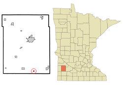 Location of Garvin, Minnesota | |
| Coordinates: 44°12′56″N 95°45′35″W | |
| Country | United States |
| State | Minnesota |
| County | Lyon |
| Government | |
| • Type | Mayor – Council |
| • Mayor | Jim Julien |
| Area | |
| • Total | 0.29 sq mi (0.75 km2) |
| • Land | 0.28 sq mi (0.72 km2) |
| • Water | 0.01 sq mi (0.03 km2) |
| Elevation | 1,539 ft (469 m) |
| Population (2020) | |
| • Total | 124 |
| • Density | 442.86/sq mi (171.23/km2) |
| Time zone | UTC-6 (Central (CST)) |
| • Summer (DST) | UTC-5 (CDT) |
| ZIP code | 56132 |
| Area code(s) | 507 |
| FIPS code | 27-23228[2] |
| GNIS feature ID | 0644051[3] |
History
Garvin was originally called Terry, for Union general Alfred Terry, and under the latter name was platted in 1886 by the railroad.[5] The present name, for H. C. Garvin, a railroad official, was adopted in 1881.[6]
Geography
According to the United States Census Bureau, the city has a total area of 0.28 square miles (0.73 km2), of which 0.27 square miles (0.70 km2) is land and 0.01 square miles (0.03 km2) is water.[7]
Demographics
| Historical population | |||
|---|---|---|---|
| Census | Pop. | %± | |
| 1950 | 264 | — | |
| 1960 | 205 | −22.3% | |
| 1970 | 201 | −2.0% | |
| 1980 | 172 | −14.4% | |
| 1990 | 149 | −13.4% | |
| 2000 | 159 | 6.7% | |
| 2010 | 135 | −15.1% | |
| 2020 | 124 | −8.1% | |
| U.S. Decennial Census[8] | |||
2010 census
As of the census[9] of 2010, there were 135 people, 52 households, and 38 families living in the city. The population density was 500.0 inhabitants per square mile (193.1/km2). There were 62 housing units at an average density of 229.6 per square mile (88.6/km2). The racial makeup of the city was 97.0% White and 3.0% from two or more races.
There were 52 households, of which 32.7% had children under the age of 18 living with them, 55.8% were married couples living together, 11.5% had a female householder with no husband present, 5.8% had a male householder with no wife present, and 26.9% were non-families. 19.2% of all households were made up of individuals. The average household size was 2.60 and the average family size was 2.97.
The median age in the city was 38.5 years. 26.7% of residents were under the age of 18; 5.9% were between the ages of 18 and 24; 27.4% were from 25 to 44; 32.5% were from 45 to 64; and 7.4% were 65 years of age or older. The gender makeup of the city was 54.1% male and 45.9% female.
2000 census
As of the census[2] of 2000, there were 159 people, 57 households, and 44 families living in the city. The population density was 590.3 people per square mile (227.4/km2). There were 68 housing units at an average density of 252.5 per square mile (97.2/km2). The racial makeup of the city was 95.60% White, 3.14% Native American, 0.63% Asian, 0.63% from other races. Hispanic or Latino of any race were 1.26% of the population.
There were 57 households, out of which 45.6% had children under the age of 18 living with them, 61.4% were married couples living together, 5.3% had a female householder with no husband present, and 22.8% were non-families. 19.3% of all households were made up of individuals, and 14.0% had someone living alone who was 65 years of age or older. The average household size was 2.79 and the average family size was 3.20.
In the city, the population was spread out, with 32.1% under the age of 18, 8.2% from 18 to 24, 31.4% from 25 to 44, 18.2% from 45 to 64, and 10.1% who were 65 years of age or older. The median age was 33 years. For every 100 females, there were 112.0 males. For every 100 females age 18 and over, there were 107.7 males.
The median income for a household in the city was $38,750, and the median income for a family was $41,429. Males had a median income of $25,556 versus $18,750 for females. The per capita income for the city was $13,108. About 7.4% of families and 8.2% of the population were below the poverty line, including 3.4% of those under the age of eighteen and 15.4% of those 65 or over.
References
- "2020 U.S. Gazetteer Files". United States Census Bureau. Retrieved July 24, 2022.
- "U.S. Census website". United States Census Bureau. Retrieved 2008-01-31.
- "US Board on Geographic Names". United States Geological Survey. 2007-10-25. Retrieved 2008-01-31.
- "2010 Census Redistricting Data (Public Law 94-171) Summary File". American FactFinder. United States Census Bureau. Retrieved 27 April 2011.[dead link]
- Chicago and North Western Railway Company (1908). A History of the Origin of the Place Names Connected with the Chicago & North Western and Chicago, St. Paul, Minneapolis & Omaha Railways. p. 75.
- Upham, Warren (1920). Minnesota Geographic Names: Their Origin and Historic Significance. Minnesota Historical Society. p. 312.
- "US Gazetteer files 2010". United States Census Bureau. Archived from the original on 2012-07-02. Retrieved 2012-11-13.
- "Census of Population and Housing". Census.gov. Retrieved June 4, 2015.
- "U.S. Census website". United States Census Bureau. Retrieved 2012-11-13.
Municipalities and communities of Lyon County, Minnesota, United States | ||
|---|---|---|
County seat: Marshall | ||
| Cities | 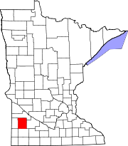 | |
| Townships | ||
| Unincorporated communities |
| |
| ||
На других языках
- [en] Garvin, Minnesota
[ru] Гарвин (город, Миннесота)
Гарвин (англ. Garvin) — город в округе Лайон, штат Миннесота, США. На площади 0,7 км² (0,7 км² — суша, водоёмов нет), согласно переписи 2002 года, проживают 159 человек. Плотность населения составляет 227,9 чел./км².Другой контент может иметь иную лицензию. Перед использованием материалов сайта WikiSort.org внимательно изучите правила лицензирования конкретных элементов наполнения сайта.
WikiSort.org - проект по пересортировке и дополнению контента Википедии