world.wikisort.org - USA
Fedora is an unincorporated community in Miner County, South Dakota, United States, founded in 1881.[3] The Census Bureau began tracking Fedora as a CDP in 2010.[4] Fedora has been assigned the ZIP code of 57337.[5] The population of the CDP was 26 at the 2020 census.[6]
Fedora | |
|---|---|
Unincorporated community | |
 Fedora Location within the state of South Dakota  Fedora Fedora (the United States) | |
| Coordinates: 44°0′32″N 97°47′26″W | |
| Country | United States |
| State | South Dakota |
| County | Miner |
| Area | |
| • Total | 3.36 sq mi (8.70 km2) |
| • Land | 3.36 sq mi (8.70 km2) |
| • Water | 0.00 sq mi (0.00 km2) |
| Population (2020)[2] | |
| • Total | 26 |
| • Density | 7.75/sq mi (2.99/km2) |
| Time zone | UTC-6 (Central (CST)) |
| • Summer (DST) | UTC-5 (CDT) |
| ZIP codes | 57337 |
| Area code | 605 |
| FIPS code | 46-21340 |
The town of Fedora was originally platted in 1881. Fedora was originally called Miner Center, until the name was changed in 1896 due to the fact that there were several towns called Miner or Miner Center in South Dakota. According to tradition, Fedora was so named on account of the fedora hats sold by a pioneer merchant.[7]
On June 13, 1943, two B-17 bombers from the 393rd Bomb Group of the Sioux City Army Air Base collided while on a training exercise over Fedora. One of the planes crashed immediately, and the other made a controlled landing in a creek bed several miles away. Eleven airmen were killed.
Demographics
| Historical population | |||
|---|---|---|---|
| Census | Pop. | %± | |
| 2020 | 26 | — | |
| U.S. Decennial Census[8] | |||
References
- "ArcGIS REST Services Directory". United States Census Bureau. Retrieved October 15, 2022.
- "Census Population API". United States Census Bureau. Retrieved Oct 15, 2022.
- "Fedora". Geographic Names Information System. United States Geological Survey, United States Department of the Interior. Retrieved 29 November 2014.
- "American FactFinder". United States Census Bureau. Archived from the original on 12 February 2020. Retrieved 29 November 2014.
- "Look Up a ZIP Code™". USPS. Retrieved 29 November 2014.
- "U.S. Census Bureau: Fedora CDP, South Dakota". www.census.gov. United States Census Bureau. Retrieved 16 January 2022.
- Federal Writers' Project (1940). South Dakota place-names, v.1-3. University of South Dakota. p. 37.
- "Census of Population and Housing". Census.gov. Retrieved June 4, 2016.
Municipalities and communities of Miner County, South Dakota, United States | ||
|---|---|---|
County seat: Howard | ||
| Cities | 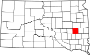 | |
| Towns | ||
| Township | ||
| CDPs | ||
| Ghost town |
| |
| ||
Authority control | |
|---|---|
| General | |
| National libraries | |
This South Dakota state location article is a stub. You can help Wikipedia by expanding it. |
Другой контент может иметь иную лицензию. Перед использованием материалов сайта WikiSort.org внимательно изучите правила лицензирования конкретных элементов наполнения сайта.
WikiSort.org - проект по пересортировке и дополнению контента Википедии