world.wikisort.org - USA
Falmouth is a census-designated place (CDP) within the town of Falmouth in Cumberland County, Maine, United States. The population was 1,855 at the 2010 census.[2] It is part of the Portland–South Portland–Biddeford, Maine Metropolitan Statistical Area.
Falmouth, Maine | |
|---|---|
Census-designated place | |
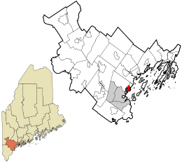 Location in Cumberland County and the state of Maine. | |
| Coordinates: 43°42′34″N 70°14′6″W | |
| Country | United States |
| State | Maine |
| County | Cumberland |
| Town | Falmouth |
| Area | |
| • Total | 3.15 sq mi (8.16 km2) |
| • Land | 2.40 sq mi (6.22 km2) |
| • Water | 0.75 sq mi (1.93 km2) |
| Elevation | 40 ft (10 m) |
| Population (2020) | |
| • Total | 1,988 |
| • Density | 827.30/sq mi (319.43/km2) |
| Time zone | UTC-5 (Eastern (EST)) |
| • Summer (DST) | UTC-4 (EDT) |
| Area code | 207 |
| FIPS code | 23-24480 |
Geography
Falmouth is located at 43°42′34″N 70°14′6″W. According to the United States Census Bureau, the CDP has a total area of 3.3 square miles (8.5 km2), of which 2.4 square miles (6.3 km2) is land and 0.81 square miles (2.1 km2), or 25.02%, is water.[3]
The Falmouth CDP is centered along U.S. Route 1 in the southeastern part of the town of Falmouth, and is bordered to the north by the CDP of Falmouth Foreside, to the east by Casco Bay, to the south by the city of Portland, and to the west by the tidal arm of the Presumpscot River and by Interstate 295.
Demographics
| Historical population | |||
|---|---|---|---|
| Census | Pop. | %± | |
| 2020 | 1,988 | — | |
| U.S. Decennial Census[4] | |||
References
- "2020 U.S. Gazetteer Files". United States Census Bureau. Retrieved April 8, 2022.
- "Profile of General Population and Housing Characteristics: 2010 Demographic Profile Data (DP-1): Falmouth CDP, Maine". United States Census Bureau. Retrieved June 13, 2012.
- "Geographic Identifiers: 2010 Demographic Profile Data (G001): Falmouth CDP, Maine". United States Census Bureau. Retrieved June 13, 2012.
- "Census of Population and Housing". Census.gov. Retrieved June 4, 2016.
Municipalities and communities of Cumberland County, Maine, United States | ||
|---|---|---|
County seat: Portland | ||
| Cities |  | |
| Towns |
| |
| CDPs |
| |
| Other villages |
| |
| ||
Другой контент может иметь иную лицензию. Перед использованием материалов сайта WikiSort.org внимательно изучите правила лицензирования конкретных элементов наполнения сайта.
WikiSort.org - проект по пересортировке и дополнению контента Википедии