world.wikisort.org - USA
Erwinville is an unincorporated community and census-designated place in West Baton Rouge Parish, Louisiana, United States. Its population was 2,192 as of the 2010 census.[3] U.S. Route 190 passes through the community.
Erwinville, Louisiana | |
|---|---|
Unincorporated community | |
 Erwinville, Louisiana  Erwinville, Louisiana | |
| Coordinates: 30°31′52″N 91°24′28″W | |
| Country | United States |
| State | Louisiana |
| Parish | West Baton Rouge |
| Area | |
| • Total | 9.52 sq mi (24.65 km2) |
| • Land | 9.52 sq mi (24.65 km2) |
| • Water | 0.00 sq mi (0.00 km2) |
| Elevation | 23 ft (7 m) |
| Population (2020) | |
| • Total | 2,275 |
| • Density | 239.00/sq mi (92.27/km2) |
| Time zone | UTC-6 (Central (CST)) |
| • Summer (DST) | UTC-5 (CDT) |
| Area code(s) | 225 |
| GNIS feature ID | 534836[2] |
Geography
According to the U.S. Census Bureau, the community has an area of 7.971 square miles (20.64 km2), all land.[3]
Demographics
| Historical population | |||
|---|---|---|---|
| Census | Pop. | %± | |
| 2020 | 2,275 | — | |
| U.S. Decennial Census[4] | |||
2020 census
| Race | Number | Percentage |
|---|---|---|
| White (non-Hispanic) | 1,466 | 64.44% |
| Black or African American (non-Hispanic) | 622 | 27.34% |
| Native American | 6 | 0.26% |
| Asian | 10 | 0.44% |
| Other/Mixed | 109 | 4.79% |
| Hispanic or Latino | 62 | 2.73% |
As of the 2020 United States census, there were 2,275 people, 918 households, and 640 families residing in the CDP.
References
- "2020 U.S. Gazetteer Files". United States Census Bureau. Retrieved March 20, 2022.
- "Erwinville". Geographic Names Information System. United States Geological Survey.
- "2010 Census Gazetteer Files - Places: Louisiana". U.S. Census Bureau. Retrieved January 14, 2017.
- "Census of Population and Housing". Census.gov. Retrieved June 4, 2016.
- "Explore Census Data". data.census.gov. Retrieved 2021-12-28.
Municipalities and communities of West Baton Rouge Parish, Louisiana, United States | ||
|---|---|---|
Parish seat: Port Allen | ||
| City | 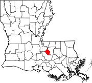 | |
| Towns |
| |
| CDP | ||
| Unincorporated communities | ||
| ||
Authority control | |
|---|---|
| General |
|
| National libraries | |
This Louisiana state location article is a stub. You can help Wikipedia by expanding it. |
Текст в блоке "Читать" взят с сайта "Википедия" и доступен по лицензии Creative Commons Attribution-ShareAlike; в отдельных случаях могут действовать дополнительные условия.
Другой контент может иметь иную лицензию. Перед использованием материалов сайта WikiSort.org внимательно изучите правила лицензирования конкретных элементов наполнения сайта.
Другой контент может иметь иную лицензию. Перед использованием материалов сайта WikiSort.org внимательно изучите правила лицензирования конкретных элементов наполнения сайта.
2019-2025
WikiSort.org - проект по пересортировке и дополнению контента Википедии
WikiSort.org - проект по пересортировке и дополнению контента Википедии