world.wikisort.org - USA
Ela is an unincorporated community in Swain County, North Carolina, United States, located along US 19, northwest of Whittier and east of Bryson City. The name is derived from ᎡᎳᏬᏗ (Elawodi) in the Cherokee language, which translates as "yellow hill."
Ela, North Carolina | |
|---|---|
Unincorporated community | |
 Ela, North Carolina  Ela, North Carolina | |
| Coordinates: 35°26′58″N 83°23′27″W | |
| Country | United States |
| State | North Carolina |
| County | Swain |
| Elevation | 1,795 ft (547 m) |
| Time zone | UTC-5 (Eastern (EST)) |
| • Summer (DST) | UTC-4 (EDT) |
| ZIP Code(s) | 28713, 28719 |
| Area code(s) | 828 |
| GNIS feature ID | 1011035[1] |
Ela was once the junction of the Appalachian Railway (1906-1935) and Southern Railway's Murphy Branch.[2]
References
- "Geographic Names Information System". United States Geological Survey. Retrieved 2008-01-31.
- Poole, Cary Franklin (1995). A History of Railroading in Western North Carolina. Johnson City, TN: The Overmountain Press. pp. 172–3.
External links
Municipalities and communities of Swain County, North Carolina, United States | ||
|---|---|---|
County seat: Bryson City | ||
| Town | 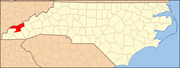 | |
| CDP | ||
| Unincorporated communities | ||
| Indian reservation | ||
| Footnotes | ‡This populated place also has portions in an adjacent county or counties | |
| ||
Текст в блоке "Читать" взят с сайта "Википедия" и доступен по лицензии Creative Commons Attribution-ShareAlike; в отдельных случаях могут действовать дополнительные условия.
Другой контент может иметь иную лицензию. Перед использованием материалов сайта WikiSort.org внимательно изучите правила лицензирования конкретных элементов наполнения сайта.
Другой контент может иметь иную лицензию. Перед использованием материалов сайта WikiSort.org внимательно изучите правила лицензирования конкретных элементов наполнения сайта.
2019-2025
WikiSort.org - проект по пересортировке и дополнению контента Википедии
WikiSort.org - проект по пересортировке и дополнению контента Википедии