world.wikisort.org - USA
Darlingtonia is an unincorporated community in Del Norte County, California. It is located on the south bank of the Middle Fork of the Smith River 1.5 miles (2.4 km) east-southeast of Gasquet,[2] at an elevation of 463 feet (141 m). It is named after the Darlingtonia californica, common in the region.[3]
Darlingtonia | |
|---|---|
Unincorporated community | |
 Darlingtonia Location in California  Darlingtonia Darlingtonia (the United States) | |
| Coordinates: 41°50′10″N 123°56′35″W | |
| Country | United States |
| State | California |
| County | Del Norte County |
| Elevation | 463 ft (141 m) |
References
- U.S. Geological Survey Geographic Names Information System: Darlingtonia, California
- Durham, David L. (1998). California's Geographic Names: A Gazetteer of Historic and Modern Names of the State. Clovis, Calif.: Word Dancer Press. p. 46. ISBN 1-884995-14-4.
- "Carnivorous plant newsletter". Biodiversity Heritage Library. 1972. Retrieved April 29, 2020.
{{cite web}}: CS1 maint: url-status (link)
External links
Municipalities and communities of Del Norte County, California, United States | ||
|---|---|---|
County seat: Crescent City | ||
| City | 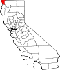 | |
| CDPs | ||
| Unincorporated communities | ||
| Indian reservations |
| |
| Ghost towns |
| |
| ||
This Del Norte County, California-related article is a stub. You can help Wikipedia by expanding it. |
Текст в блоке "Читать" взят с сайта "Википедия" и доступен по лицензии Creative Commons Attribution-ShareAlike; в отдельных случаях могут действовать дополнительные условия.
Другой контент может иметь иную лицензию. Перед использованием материалов сайта WikiSort.org внимательно изучите правила лицензирования конкретных элементов наполнения сайта.
Другой контент может иметь иную лицензию. Перед использованием материалов сайта WikiSort.org внимательно изучите правила лицензирования конкретных элементов наполнения сайта.
2019-2026
WikiSort.org - проект по пересортировке и дополнению контента Википедии
WikiSort.org - проект по пересортировке и дополнению контента Википедии