world.wikisort.org - USA
Colfax Township is a township in Champaign County, Illinois, USA. As of the 2010 census, its population was 266 and it contained 116 housing units.[2]
Colfax Township | |
|---|---|
Township | |
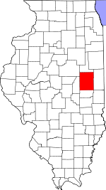
 Location in Champaign County | |
 Champaign County's location in Illinois | |
| Coordinates: 40°01′07″N 88°23′57″W | |
| Country | United States |
| State | Illinois |
| County | Champaign |
| Area | |
| • Total | 36.3 sq mi (94 km2) |
| • Land | 36.29 sq mi (94.0 km2) |
| • Water | 0.01 sq mi (0.03 km2) 0.03% |
| Elevation | 689 ft (210 m) |
| Population (2010) | |
| • Estimate (2016)[1] | 264 |
| • Density | 7.3/sq mi (2.8/km2) |
| Time zone | UTC-6 (CST) |
| • Summer (DST) | UTC-5 (CDT) |
| FIPS code | 17-019-15482 |
History
Colfax Township formed from Tolono Township in 1869.[3]
Geography
Colfax is Township 18 North, Range 7 East of the Third Principal Meridian.
According to the 2010 census, the township has a total area of 36.3 square miles (94 km2), of which 36.29 square miles (94.0 km2) (or 99.97%) is land and 0.01 square miles (0.026 km2) (or 0.03%) is water.[2]
Blue Mound, a glacial kame in Section 7, is the highest point in the township. A pole barn and a few trees are all that remain of the farmstead that once occupied the site.
Unincorporated towns
- Giblin
(This list is based on USGS data and may include former settlements.)
Cemeteries
The township contains six cemeteries: Craw, Davis Memorial, Deadman's Grove, Dunkard, Dunn and Saint Boniface.
Demographics
| Historical population | |||
|---|---|---|---|
| Census | Pop. | %± | |
| 2016 (est.) | 264 | [1] | |
| U.S. Decennial Census[4] | |||
References
- "Colfax Township, Champaign County, Illinois". Geographic Names Information System. United States Geological Survey. Retrieved 2010-01-04.
- United States Census Bureau cartographic boundary files
- "Population and Housing Unit Estimates". Retrieved June 9, 2017.
- "Population, Housing Units, Area, and Density: 2010 - County -- County Subdivision and Place -- 2010 Census Summary File 1". United States Census. Archived from the original on 2020-02-12. Retrieved 2013-05-28.
- http://history.rays-place.com/il/cham-colfax.htm [dead link]
- "Census of Population and Housing". Census.gov. Retrieved June 4, 2016.
External links
Places adjacent to Colfax Township, Champaign County, Illinois | ||||||||||||||||
|---|---|---|---|---|---|---|---|---|---|---|---|---|---|---|---|---|
| ||||||||||||||||
Municipalities and communities of Champaign County, Illinois, United States | ||
|---|---|---|
County seat: Urbana | ||
| Cities |
|  |
| Villages |
| |
| Townships | ||
| CDPs |
| |
| Other unincorporated communities |
| |
| Ghost town |
| |
| Footnotes | ‡This populated place also has portions in an adjacent county or counties | |
| ||
Другой контент может иметь иную лицензию. Перед использованием материалов сайта WikiSort.org внимательно изучите правила лицензирования конкретных элементов наполнения сайта.
WikiSort.org - проект по пересортировке и дополнению контента Википедии