world.wikisort.org - USA
Cokeville is a town in Lincoln County, Wyoming, United States. The population was 535 at the 2010 census. The town is best known for the Cokeville Elementary School hostage crisis, which led to a movie.
Cokeville, Wyoming | |
|---|---|
Town | |
| Motto(s): "Welcome to the Open Range!" | |
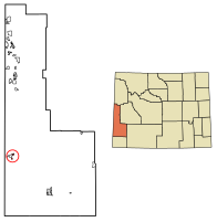 Location of Cokeville in Lincoln County, Wyoming. | |
 Cokeville, Wyoming Location in the United States | |
| Coordinates: 42°5′6″N 110°57′20″W | |
| Country | United States |
| State | Wyoming |
| County | Lincoln |
| Government | |
| • Type | Council–Manager |
| • Mayor | Eric Larsen |
| Area | |
| • Total | 1.30 sq mi (3.38 km2) |
| • Land | 1.30 sq mi (3.38 km2) |
| • Water | 0.00 sq mi (0.00 km2) |
| Elevation | 6,194 ft (1,888 m) |
| Population (2010)[2] | |
| • Total | 535 |
| • Estimate (2019)[3] | 554 |
| • Density | 424.52/sq mi (163.95/km2) |
| Time zone | UTC-7 (Mountain (MST)) |
| • Summer (DST) | UTC-6 (MDT) |
| ZIP code | 83114 |
| Area code(s) | 307 |
| FIPS code | 56-15905[4] |
| GNIS feature ID | 1609079[5] |
History
The Shoshone Indians were the first inhabitants of the area. The first Euro-American settler, Tilford Kutch, arrived in 1869. In 1873, he opened a trading post and ran a ferry across Smiths Fork. After the arrival of the railroad in 1882, the town grew, and was incorporated in 1910.[6]
The town was named for the coal found in the area.[7] Following the railroad, sheep ranching became more popular, reaching its peak in 1918, when Cokeville was informally called the "Sheep Capital of the World".
On May 16, 1986, former town marshal David Young and his wife Doris Young took 167 children and adults hostage at Cokeville Elementary School. During the Cokeville Elementary School hostage crisis. The children and adults escaped after the bomb exploded. Both hostage takers died, while 79 hostages were wounded.[8]
Geography
Cokeville is located at 42°5′6″N 110°57′20″W (42.084940, −110.955684).[9]
According to the United States Census Bureau, the town has a total area of 1.18 square miles (3.06 km2), all land.[10]
Demographics
| Historical population | |||
|---|---|---|---|
| Census | Pop. | %± | |
| 1880 | 62 | — | |
| 1920 | 430 | — | |
| 1930 | 431 | 0.2% | |
| 1940 | 452 | 4.9% | |
| 1950 | 440 | −2.7% | |
| 1960 | 545 | 23.9% | |
| 1970 | 440 | −19.3% | |
| 1980 | 515 | 17.0% | |
| 1990 | 493 | −4.3% | |
| 2000 | 506 | 2.6% | |
| 2010 | 535 | 5.7% | |
| 2019 (est.) | 554 | [3] | 3.6% |
| U.S. Decennial Census[11] | |||
2010 census
As of the census[2] of 2010, there were 535 people, 166 households, and 127 families residing in the town. The population density was 453.4 inhabitants per square mile (175.1/km2). There were 200 housing units at an average density of 169.5 per square mile (65.4/km2). The racial makeup of the town was 98.7% White, 0.4% Native American, 0.6% from other races, and 0.4% from two or more races. Hispanic or Latino of any race were 1.5% of the population.
There were 166 households, of which 45.8% had children under the age of 18 living with them, 69.3% were married couples living together, 6.0% had a female householder with no husband present, 1.2% had a male householder with no wife present, and 23.5% were non-families. 21.7% of all households were made up of individuals, and 9.6% had someone living alone who was 65 years of age or older. The average household size was 3.22 and the average family size was 3.87.
The median age in the town was 29.6 years. 41.5% of residents were under the age of 18; 4.7% were between the ages of 18 and 24; 21.1% were from 25 to 44; 21.7% were from 45 to 64; and 11% were 65 years of age or older. The gender makeup of the town was 51.4% male and 48.6% female.
2000 census
As of the census[4] of 2000, there were 506 people, 166 households, and 125 families residing in the town. The population density was 693.2 people per square mile (267.6/km2). There were 195 housing units at an average density of 267.2 per square mile (103.1/km2). The racial makeup of the town was 95.83% White, 0.40% African American, 2.0% Pacific Islander, 0.99% from other races, and 0.79% from two or more races. Hispanic or Latino of any race were 2.37% of the population.
There were 166 households, out of which 37.3% had children under the age of 18 living with them, 69.3% were married couples living together, 4.8% had a female householder with no husband present, and 24.1% were non-families. 21.7% of all households were made up of individuals, and 9.0% had someone living alone who was 65 years of age or older. The average household size was 3.05 and the average family size was 3.66.
In the town, the population was spread out, with 37.0% under the age of 18, 8.3% from 18 to 24, 19.4% from 25 to 44, 21.1% from 45 to 64, and 14.2% who were 65 years of age or older. The median age was 31 years. For every 100 females, there were 103.2 males. For every 100 females age 18 and over, there were 98.1 males.
The median income for a household in the town was $31,705, and the median income for a family was $39,000. Males had a median income of $35,000 versus $22,083 for females. The per capita income for the town was $12,900. About 7.1% of families and 10.4% of the population were below the poverty line, including 15.9% of those under age 18 and none of those age 65 or over.
Education
Public education in the town of Cokeville is provided by Lincoln County School District #2. Zoned campuses include Cokeville Elementary School (grades K-6) and Cokeville High School (grades 7–12).
Cokeville has a public library, a branch of the Lincoln County Library System.[12]
Infrastructure
Transportation by air
Cokeville Municipal Airport (U06) is an operational municipal airport serving the Town of Cokeville and surrounding areas. It is 3 nautical miles (6 km) south of Cokeville. The airport is located on CR 207, and can be accessible by WYO 231, and from east of Laketown, Utah, by Manhead Road. The airport is 6,270 feet (1,911 m) above sea level, and 320 acres (1.3 km2) big. It is owned by the town hall of Cokeville.
Transportation by road
 WYO 231 is a spur of US 30, and is the "main street" of Cokeville.
 US 30 is the only thoroughfare of the town, and provides access to Interstate 80 and nearby Idaho.
 WYO 232 branches off US 30 that serves a rural area northeast of Cokeville. If you went straight after US 30, you'll be on WYO 231.
Notable people
- Minerva Teichert (1888–1976), Western and LDS artist
See also
- List of municipalities in Wyoming
References
- "2019 U.S. Gazetteer Files". United States Census Bureau. Retrieved August 7, 2020.
- "U.S. Census website". United States Census Bureau. Retrieved 2012-12-14.
- "Population and Housing Unit Estimates". United States Census Bureau. May 24, 2020. Retrieved May 27, 2020.
- "U.S. Census website". United States Census Bureau. Retrieved 2008-01-31.
- "US Board on Geographic Names". United States Geological Survey. 2007-10-25. Retrieved 2008-01-31.
- "Cokeville, Wyoming". City-Data.com. Retrieved July 17, 2012.
- "Profile for Cokeville, Wyoming, WY". ePodunk. Retrieved July 20, 2012.
- "25 years after school bombing, Wyoming town remembers story of survival". The Billings Gazette. Retrieved July 20, 2012.
- "US Gazetteer files: 2010, 2000, and 1990". United States Census Bureau. 2011-02-12. Retrieved 2011-04-23.
- "US Gazetteer files 2010". United States Census Bureau. Archived from the original on 2012-07-02. Retrieved 2012-12-14.
- "Census of Population and Housing". Census.gov. Retrieved June 4, 2015.
- "Wyoming Public Libraries". PublicLibraries.com. Retrieved 13 June 2019.
External links
| Wikimedia Commons has media related to Cokeville, Wyoming. |
Municipalities and communities of Lincoln County, Wyoming, United States | ||
|---|---|---|
County seat: Kemmerer | ||
| City |
|  |
| Towns |
| |
| CDPs |
| |
| Unincorporated communities |
| |
| Footnotes | ‡This populated place also extends into Idaho | |
| ||
Authority control | |
|---|---|
| General | |
| National libraries | |
На других языках
- [en] Cokeville, Wyoming
[ru] Коквилл (Вайоминг)
Коквилл (англ. Cokeville, Wyoming) — город, расположенный в округе Линкольн (штат Вайоминг, США) с населением в 506 человек по статистическим данным переписи 2000 года.Другой контент может иметь иную лицензию. Перед использованием материалов сайта WikiSort.org внимательно изучите правила лицензирования конкретных элементов наполнения сайта.
WikiSort.org - проект по пересортировке и дополнению контента Википедии