world.wikisort.org - USA
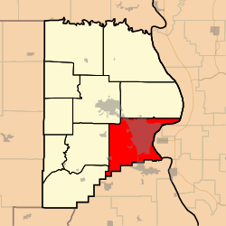
Cape Girardeau Township is one of ten townships in Cape Girardeau County, Missouri, USA. As of the 2000 census, its population was 37,778.
Cape Girardeau Township | |
|---|---|
Township | |
 | |
| Coordinates: 37°18′46″N 089°32′25″W | |
| Country | United States |
| State | Missouri |
| County | Cape Girardeau |
| Area | |
| • Total | 70.46 sq mi (182.5 km2) |
| • Land | 67.08 sq mi (173.73 km2) |
| • Water | 3.39 sq mi (8.77 km2) 4.81% |
| Elevation | 390 ft (119 m) |
| Population (2000) | |
| • Total | 37,778 |
| • Density | 563.2/sq mi (217.5/km2) |
| FIPS code | 29-11260[2] |
| GNIS feature ID | 0766397 |
History
Cape Girardeau Township was founded in 1807.[3] The township took its name from the city of Cape Girardeau.[4]
Geography
Cape Girardeau Township covers an area of 70.46 square miles (182.5 km2) and contains one incorporated settlement, Cape Girardeau. It contains fifteen cemeteries: County Memorial Park, Davis, Fairmon, Hitt, Hitt, Hitt, Lorimier, McGuire, Mount Auburn, Nunn, Old Hanover, Saint Marys, Salem, Shady Grove and Suedekum.
The streams of Cape La Croix Creek, Flora Creek, Juden Creek, Ramsey Branch, Randol Creek, Ranney Creek, Scism Creek and Sloan Creek run through this township.
Transportation
Cape Girardeau Township contains two airports or landing strips: Saint Francis Hospital Heliport and Southeast Missouri Hospital Heliport.
References
- "US Board on Geographic Names". United States Geological Survey. 2007-10-25. Retrieved 2008-01-31.
- "U.S. Census website". United States Census Bureau. Retrieved 2008-01-31.
- History of Southeast Missouri: A Narrative Account of Its Historical Progress, Its People and Its Principal Interests, Volume 1. Lewis Publishing Company. 1912. p. 163.
- "Cape Girardeau County Place Names, 1928–1945 (archived)". The State Historical Society of Missouri. Archived from the original on 24 June 2016. Retrieved 10 September 2016.
{{cite web}}: CS1 maint: bot: original URL status unknown (link)
External links
Municipalities and communities of Cape Girardeau County, Missouri, United States | ||
|---|---|---|
County seat: Jackson | ||
| Cities |
|  |
| Villages | ||
| Townships | ||
| CDPs |
| |
| Other communities |
| |
| Ghost towns |
| |
| Footnotes | ‡This populated place also has portions in an adjacent county or counties | |
| ||
This Cape Girardeau County, Missouri state location article is a stub. You can help Wikipedia by expanding it. |
На других языках
[de] Cape Girardeau Township
Die Cape Girardeau Township ist eine von 10 Townships im Cape Girardeau County im Südosten des US-amerikanischen Bundesstaates Missouri.- [en] Cape Girardeau Township, Cape Girardeau County, Missouri
Другой контент может иметь иную лицензию. Перед использованием материалов сайта WikiSort.org внимательно изучите правила лицензирования конкретных элементов наполнения сайта.
WikiSort.org - проект по пересортировке и дополнению контента Википедии