world.wikisort.org - USA
Brownlee is an unincorporated community and census-designated place in Cherry County, Nebraska, United States.[3] As of the 2010 census it had a population of 15.[4] It is located on the North Loup River, 5 miles (8 km) west of U.S. Route 83 in the Sandhills region of the state.
Brownlee, Nebraska | |
|---|---|
Unincorporated Community and Census-Designated Place | |
 | |
 Brownlee, Nebraska | |
| Coordinates: 42.3°N 100.6°W | |
| Country | |
| State | |
| County | Cherry |
| Area | |
| • Total | 0.11 sq mi (0.28 km2) |
| • Land | 0.11 sq mi (0.28 km2) |
| • Water | 0.00 sq mi (0.00 km2) |
| Population (2020) | |
| • Total | 13 |
| • Density | 122.64/sq mi (47.19/km2) |
| FIPS code | 31-06680 |
| GNIS feature ID | 827691[2] |
History
Brownlee was given the maiden name of the founder's grandmother.[5]
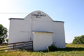 Community Hall
 Mailboxes
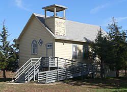 Brownlee church


Demographics
| Historical population | |||
|---|---|---|---|
| Census | Pop. | %± | |
| 2010 | 15 | — | |
| 2020 | 13 | −13.3% | |
| U.S. Decennial Census[6] | |||
References
- "ArcGIS REST Services Directory". United States Census Bureau. Retrieved September 19, 2022.
- U.S. Geological Survey Geographic Names Information System: Brownlee, Nebraska
- U.S. Geological Survey Geographic Names Information System: Brownlee, Nebraska
- "Geographic Identifiers: 2010 Demographic Profile Data (G001): Brownlee CDP, Nebraska". U.S. Census Bureau, American actfinder. Archived from the original on February 12, 2020. Retrieved October 15, 2014.
- Federal Writers' Project (1938). Origin of Nebraska place names. Lincoln, NE: Works Progress Administration. p. 7.
- "Census of Population and Housing". Census.gov. Retrieved June 4, 2016.
Wikimedia Commons has media related to Brownlee, Nebraska.
Municipalities and communities of Cherry County, Nebraska, United States | ||
|---|---|---|
County seat: Valentine | ||
| City |  | |
| Villages | ||
| CDP | ||
| Other unincorporated communities | ||
| Ghost towns |
| |
| ||
This Cherry County, Nebraska state location article is a stub. You can help Wikipedia by expanding it. |
Текст в блоке "Читать" взят с сайта "Википедия" и доступен по лицензии Creative Commons Attribution-ShareAlike; в отдельных случаях могут действовать дополнительные условия.
Другой контент может иметь иную лицензию. Перед использованием материалов сайта WikiSort.org внимательно изучите правила лицензирования конкретных элементов наполнения сайта.
Другой контент может иметь иную лицензию. Перед использованием материалов сайта WikiSort.org внимательно изучите правила лицензирования конкретных элементов наполнения сайта.
2019-2026
WikiSort.org - проект по пересортировке и дополнению контента Википедии
WikiSort.org - проект по пересортировке и дополнению контента Википедии