world.wikisort.org - USA
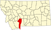
Bridger is a census-designated place (CDP) in Gallatin County, Montana, United States. It comprises the Bridger Bowl Ski Area and some nearby residences on the eastern side of the Bridger Range in southwestern Montana. As of the 2010 census the Bridger CDP had a population of 30.[2]
Bridger, Gallatin County, Montana | |
|---|---|
Census-designated place | |
 Bridger  Bridger | |
| Coordinates: 45°49′3″N 110°53′34″W | |
| Country | United States |
| State | Montana |
| County | Gallatin |
| Area | |
| • Total | 3.60 sq mi (9.34 km2) |
| • Land | 3.60 sq mi (9.32 km2) |
| • Water | 0.01 sq mi (0.01 km2) |
| Elevation | 6,040 ft (1,840 m) |
| Population (2020) | |
| • Total | 72 |
| • Density | 20.01/sq mi (7.72/km2) |
| Time zone | UTC-7 (Mountain (MST)) |
| • Summer (DST) | UTC-6 (MDT) |
| Area code | 406 |
| FIPS code | 30-09500 |
| GNIS feature ID | 2583793 |
Montana Highway 86 forms the eastern edge of the CDP, leading north and east 23 miles (37 km) to Wilsall and south and west 16 miles (26 km) to Bozeman. Bridger Creek, a tributary of the Gallatin River, flows southwards through the eastern part of the CDP.
According to the U.S. Census Bureau, the Bridger CDP has a total area of 3.6 square miles (9.3 km2), of which 0.004 square miles (0.01 km2), or 0.16%, is water.[2]
Demographics
| Historical population | |||
|---|---|---|---|
| Census | Pop. | %± | |
| 2020 | 72 | — | |
| U.S. Decennial Census[3] | |||
References
- "ArcGIS REST Services Directory". United States Census Bureau. Retrieved September 5, 2022.
- "Geographic Identifiers: 2010 Demographic Profile Data (G001): Bridger CDP, Montana". American Factfinder. U.S. Census Bureau. Retrieved December 21, 2016.[dead link]
- "Census of Population and Housing". Census.gov. Retrieved June 4, 2016.
Текст в блоке "Читать" взят с сайта "Википедия" и доступен по лицензии Creative Commons Attribution-ShareAlike; в отдельных случаях могут действовать дополнительные условия.
Другой контент может иметь иную лицензию. Перед использованием материалов сайта WikiSort.org внимательно изучите правила лицензирования конкретных элементов наполнения сайта.
Другой контент может иметь иную лицензию. Перед использованием материалов сайта WikiSort.org внимательно изучите правила лицензирования конкретных элементов наполнения сайта.
2019-2025
WikiSort.org - проект по пересортировке и дополнению контента Википедии
WikiSort.org - проект по пересортировке и дополнению контента Википедии
