world.wikisort.org - USA
Branch is an unincorporated community and census-designated place in Acadia Parish, Louisiana, United States. As of the 2010 census, it had a population of 388.[2]
Branch, Louisiana | |
|---|---|
Census-designated place | |
 Branch Location within the state of Louisiana | |
| Coordinates: 30°20′55″N 92°16′3″W | |
| Country | United States |
| State | Louisiana |
| Parish | Acadia |
| Area | |
| • Total | 7.38 sq mi (19.11 km2) |
| • Land | 7.36 sq mi (19.05 km2) |
| • Water | 0.02 sq mi (0.06 km2) |
| Elevation | 39 ft (12 m) |
| Population (2020) | |
| • Total | 431 |
| • Density | 58.59/sq mi (22.62/km2) |
| Time zone | UTC-6 (Central (CST)) |
| • Summer (DST) | UTC-5 (CST) |
| ZIP code | 70516 |
| FIPS code | 22-09235 |
Branch is located on LA-35 near the LA-365 intersection, approximately 5 miles (8 km) south of the town of Church Point and 8 miles (13 km) north of the city of Rayne.
Demographics
| Historical population | |||
|---|---|---|---|
| Census | Pop. | %± | |
| 2020 | 431 | — | |
| U.S. Decennial Census[3] | |||
References
- "2020 U.S. Gazetteer Files". United States Census Bureau. Retrieved March 20, 2022.
- "Geographic Identifiers: 2010 Demographic Profile Data (G001): Branch CDP, Louisiana". U.S. Census Bureau, American Factfinder. Archived from the original on February 12, 2020. Retrieved May 14, 2013.
- "Census of Population and Housing". Census.gov. Retrieved June 4, 2016.
Municipalities and communities of Acadia Parish, Louisiana, United States | ||
|---|---|---|
Parish seat: Crowley | ||
| Cities | 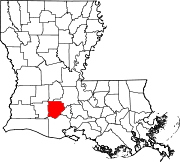 | |
| Towns |
| |
| Villages |
| |
| CDPs | ||
| Other unincorporated communities | ||
| Footnotes | ‡This populated place also has portions in an adjacent parish or parishes | |
| ||
This Louisiana state location article is a stub. You can help Wikipedia by expanding it. |
Текст в блоке "Читать" взят с сайта "Википедия" и доступен по лицензии Creative Commons Attribution-ShareAlike; в отдельных случаях могут действовать дополнительные условия.
Другой контент может иметь иную лицензию. Перед использованием материалов сайта WikiSort.org внимательно изучите правила лицензирования конкретных элементов наполнения сайта.
Другой контент может иметь иную лицензию. Перед использованием материалов сайта WikiSort.org внимательно изучите правила лицензирования конкретных элементов наполнения сайта.
2019-2026
WikiSort.org - проект по пересортировке и дополнению контента Википедии
WikiSort.org - проект по пересортировке и дополнению контента Википедии