world.wikisort.org - USA
Baldridge is an unincorporated community in Curry Township, Sullivan County, in the U.S. state of Indiana.[2]
Baldridge, Indiana | |
|---|---|
Unincorporated community | |
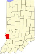 Sullivan County's location in Indiana | |
 Baldridge Location in Sullivan County, Indiana | |
| Coordinates: 39°13′22″N 87°22′13″W | |
| Country | United States |
| State | Indiana |
| County | Sullivan |
| Township | Curry |
| Elevation | 591 ft (180 m) |
| Time zone | UTC-5 (Eastern (EST)) |
| • Summer (DST) | UTC-4 (EDT) |
| ZIP code | 47850 |
| Area codes | 812, 930 |
| GNIS feature ID | 430450 |
The community is part of the Terre Haute Metropolitan Statistical Area.
History
Baldridge likely takes its name from a nearby coal mine.[3]
Geography
Baldridge is located at 39°13′22″N 87°22′13″W.
References
- "US Board on Geographic Names". United States Geological Survey. October 25, 2007. Retrieved 2016-08-30.
- "Baldridge, Indiana". Geographic Names Information System. United States Geological Survey. Retrieved August 5, 2017.
- Baker, Ronald L. (October 1995). From Needmore to Prosperity: Hoosier Place Names in Folklore and History. Indiana University Press. p. 59. ISBN 978-0-253-32866-3.
...this village was named for a local coal mine.
Municipalities and communities of Sullivan County, Indiana, United States | ||
|---|---|---|
County seat: Sullivan | ||
| Cities |
|  |
| Towns |
| |
| Townships | ||
| Unincorporated communities |
| |
| Ghost towns |
| |
| Footnotes | ‡This populated place also has portions in an adjacent county or counties | |
| ||
This Sullivan County, Indiana location article is a stub. You can help Wikipedia by expanding it. |
Текст в блоке "Читать" взят с сайта "Википедия" и доступен по лицензии Creative Commons Attribution-ShareAlike; в отдельных случаях могут действовать дополнительные условия.
Другой контент может иметь иную лицензию. Перед использованием материалов сайта WikiSort.org внимательно изучите правила лицензирования конкретных элементов наполнения сайта.
Другой контент может иметь иную лицензию. Перед использованием материалов сайта WikiSort.org внимательно изучите правила лицензирования конкретных элементов наполнения сайта.
2019-2026
WikiSort.org - проект по пересортировке и дополнению контента Википедии
WikiSort.org - проект по пересортировке и дополнению контента Википедии