world.wikisort.org - USA
Athol is a city in Kootenai County, Idaho, United States. The population was 692 at the 2010 census, up from 676 in 2000.[4] It is part of the Coeur d'Alene Metropolitan Statistical Area, which includes the entire county.
Athol, Idaho | |
|---|---|
City | |
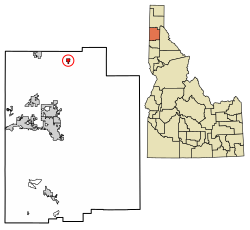 Location of Athol in Kootenai County, Idaho. | |
 Athol, Idaho Location in the United States | |
| Coordinates: 47°56′46″N 116°42′26″W | |
| Country | United States |
| State | Idaho |
| County | Kootenai |
| Incorporated | 1909 |
| Area | |
| • Total | 0.89 sq mi (2.30 km2) |
| • Land | 0.89 sq mi (2.30 km2) |
| • Water | 0.00 sq mi (0.00 km2) |
| Elevation | 2,392 ft (729 m) |
| Population (2010)[2] | |
| • Total | 692 |
| • Estimate (2019)[3] | 792 |
| • Density | 890.89/sq mi (343.82/km2) |
| Time zone | UTC-8 (Pacific (PST)) |
| • Summer (DST) | UTC-7 (PDT) |
| ZIP code | 83801 |
| Area code | 208 |
| FIPS code | 16-03700 |
| GNIS feature ID | 0376763 |
| Website | cityofathol |
Athol is notable for being the location of Silverwood theme park. Several miles east of town is historic Farragut State Park, located at the southern end of Lake Pend Oreille. Once completed, the planned Dollar General location will be the chain's first storefront in the state of Idaho.[5]
History
This section needs expansion. You can help by adding to it. (May 2022) |
A post office called Athol has been in operation since 1895.[6] The city may be named after the Duke of Atholl.[7]
Geography
Athol is located at 47°56′46″N 116°42′26″W (47.946024, -116.707349),[8] at an elevation of 2,392 feet (729 m) above sea level.
According to the United States Census Bureau, the city has a total area of 0.79 square miles (2.05 km2), all of it land.[9]
Demographics
| Historical population | |||
|---|---|---|---|
| Census | Pop. | %± | |
| 1910 | 281 | — | |
| 1920 | 180 | −35.9% | |
| 1930 | 116 | −35.6% | |
| 1940 | 120 | 3.4% | |
| 1950 | 226 | 88.3% | |
| 1960 | 214 | −5.3% | |
| 1970 | 190 | −11.2% | |
| 1980 | 312 | 64.2% | |
| 1990 | 346 | 10.9% | |
| 2000 | 676 | 95.4% | |
| 2010 | 692 | 2.4% | |
| 2019 (est.) | 792 | [3] | 14.5% |
| U.S. Decennial Census[10] | |||
As of 2000 the median income for a household in the city was $30,595, and the median income for a family was $31,875. Males had a median income of $28,438 versus $17,813 for females. The per capita income for the city was $13,632. About 11.0% of families and 14.5% of the population were below the poverty line, including 10.3% of those under age 18 and 23.7% of those age 65 or over.
2010 census
As of the census[2] of 2010, there were 692 people, 282 households, and 176 families residing in the city. The population density was 875.9 inhabitants per square mile (338.2/km2). There were 305 housing units at an average density of 386.1 per square mile (149.1/km2). The racial makeup of the city was 97.0% White, 0.9% Native American, and 2.2% from two or more races. Hispanic or Latino of any race were 0.3% of the population.
There were 282 households, of which 29.4% had children under the age of 18 living with them, 47.9% were married couples living together, 8.9% had a female householder with no husband present, 5.7% had a male householder with no wife present, and 37.6% were non-families. 28.0% of all households were made up of individuals, and 10.3% had someone living alone who was 65 years of age or older. The average household size was 2.45 and the average family size was 3.05.
The median age in the city was 41.8 years. 23.7% of residents were under the age of 18; 6.7% were between the ages of 18 and 24; 23.2% were from 25 to 44; 30.8% were from 45 to 64; and 15.6% were 65 years of age or older. The gender makeup of the city was 52.2% male and 47.8% female.
See also
- Duke of Atholl
- Athol, Massachusetts
Notable person
- Hattie Johnson, Olympic shooter, resident of Athol
References
- "2019 U.S. Gazetteer Files". United States Census Bureau. Retrieved July 9, 2020.
- "U.S. Census website". United States Census Bureau. Retrieved 2012-12-18.
- "Population and Housing Unit Estimates". United States Census Bureau. May 24, 2020. Retrieved May 27, 2020.
- Spokesman-Review Archived 2016-03-04 at the Wayback Machine - 2010 census - Athol, Idaho - accessed 2011-12-26
- https://sg.finance.yahoo.com/news/dollar-general-announces-planned-expansion-105500384.html From Yahoo Finance, accessed Nov. 9th 2021
- "Kootenai County". Jim Forte Postal History. Archived from the original on 31 May 2015. Retrieved 30 May 2015.
- Taggart, Cynthia (Sep 6, 1985). "What's in a name?". Spokane Chronicle. p. 3. Retrieved 30 May 2015.
- "US Gazetteer files: 2010, 2000, and 1990". United States Census Bureau. 2011-02-12. Retrieved 2011-04-23.
- "US Gazetteer files 2010". United States Census Bureau. Archived from the original on 2012-01-25. Retrieved 2012-12-18.
- "Census of Population and Housing". Census.gov. Retrieved June 4, 2015.
External links
- Kootenai-Shoshone Area Libraries - Athol
Municipalities and communities of Kootenai County, Idaho, United States | ||
|---|---|---|
County seat: Coeur d'Alene | ||
| Cities |  | |
| CDPs | ||
| Unincorporated communities |
| |
| Indian reservation |
| |
| Footnotes | ‡This populated place also has portions in an adjacent county or counties | |
| ||
Authority control | |
|---|---|
| General |
|
| National libraries | |
На других языках
[de] Athol (Idaho)
Athol ist eine Stadt im Kootenai County im US-Bundesstaat Idaho. Der Ort hatte 2020 709 Einwohner.- [en] Athol, Idaho
Другой контент может иметь иную лицензию. Перед использованием материалов сайта WikiSort.org внимательно изучите правила лицензирования конкретных элементов наполнения сайта.
WikiSort.org - проект по пересортировке и дополнению контента Википедии