world.wikisort.org - USA
Atchafalaya is a ghost town that was located in St. Martin Parish, approximately 6 miles north of Butte La Rose, Louisiana, United States and just north of I-10 on the Atchafalaya River. The site of the town itself is located at coordinates 30°20'40.9"N 91°43'26.8"W, and is abandoned. United States Geological Survey maps from 1935 [1] show the town to be located on the east bank of the Atchafalaya River at the Southern Pacific Railroad crossing, which was built in 1908. After the bridge was damaged due to the Great Mississippi Flood of 1927, the railroad from Lafayette to Baton Rouge was abandoned a few years later. With no transportation in and out, the town population began to dwindle, with the last resident leaving in 1959.[2] There is no visible trace of the town left today.
Atchafalaya | |
|---|---|
Ghost town | |
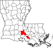
 Atchafalaya Location within the state of Louisiana | |
| Coordinates: 30°20′46.6″N 91°43′09.6″W | |
| Country | United States |
| State | Louisiana |
| Parish | St. Martin |
| Time zone | UTC-6 (Central (CST)) |
| • Summer (DST) | UTC-5 (CDT) |
See also
- Butte La Rose - a town in neighboring St. Martin Parish.
- Krotz Springs - a town in neighboring St. Landry Parish.
References
- "USGS Map Osca Bayou 1935 – image: LA_Osca Bayou_334896_1935_62500_geo.tif, (5071 × 6467 px)". prd-tnm.s3.amazonaws.com. Retrieved 2020-12-31.
- "Atchafalaya Honey and Other Swamp Gold". Country Roads Magazine. Retrieved 2020-12-31.
Municipalities and communities of St. Martin Parish, Louisiana, United States | ||
|---|---|---|
Parish seat: St. Martinville | ||
| Cities |
|  |
| Towns |
| |
| Village |
| |
| CDPs |
| |
| Other communities |
| |
| Ghost town |
| |
| Footnotes | ‡This populated place also has portions in an adjacent parish or parishes | |
| ||
This Louisiana state location article is a stub. You can help Wikipedia by expanding it. |
Другой контент может иметь иную лицензию. Перед использованием материалов сайта WikiSort.org внимательно изучите правила лицензирования конкретных элементов наполнения сайта.
WikiSort.org - проект по пересортировке и дополнению контента Википедии