world.wikisort.org - USA
Angola is an unincorporated community in Labette County, Kansas, United States.[1]
Angola, Kansas | |
|---|---|
Unincorporated community | |
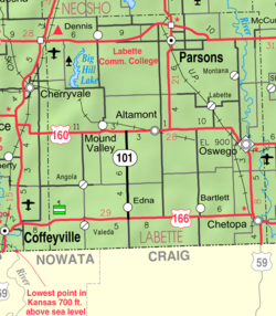 KDOT map of Labette County (legend) | |
 Angola  Angola | |
| Coordinates: 37°6′20″N 95°26′58″W[1] | |
| Country | United States |
| State | Kansas |
| County | Labette |
| Founded | 1886 |
| Platted | 1886 |
| Elevation | 787 ft (240 m) |
| Time zone | UTC-6 (CST) |
| • Summer (DST) | UTC-5 (CDT) |
| Area code | 620 |
| FIPS code | 20-01850 [1] |
| GNIS ID | 469166 [1] |
History
Angola was laid out in 1886.[2] The post office was established January 31, 1887, and discontinued September 16, 1971. The community was served by the Missouri-Kansas-Texas Railroad for many years, however flooding on the Verdigris River washed out the railroad bridge in the 1970s and rail traffic was thereafter re-routed, no longer passing through Angola.
Education
The community is served by Labette County USD 506 public school district.
References
- "Angola, Kansas", Geographic Names Information System, United States Geological Survey
- Blackmar, Frank Wilson (1912). Kansas: A Cyclopedia of State History, Embracing Events, Institutions, Industries, Counties, Cities, Towns, Prominent Persons, Etc. Standard Publishing Company. pp. 77.
Further reading
External links
Municipalities and communities of Labette County, Kansas, United States | ||
|---|---|---|
County seat: Oswego | ||
| Cities |  | |
| Unincorporated communities |
| |
| Ghost towns |
| |
| Townships |
| |
| Footnotes | †This community is designated a Census-Designated Place (CDP) by the United States Census Bureau. | |
| ||
Текст в блоке "Читать" взят с сайта "Википедия" и доступен по лицензии Creative Commons Attribution-ShareAlike; в отдельных случаях могут действовать дополнительные условия.
Другой контент может иметь иную лицензию. Перед использованием материалов сайта WikiSort.org внимательно изучите правила лицензирования конкретных элементов наполнения сайта.
Другой контент может иметь иную лицензию. Перед использованием материалов сайта WikiSort.org внимательно изучите правила лицензирования конкретных элементов наполнения сайта.
2019-2026
WikiSort.org - проект по пересортировке и дополнению контента Википедии
WikiSort.org - проект по пересортировке и дополнению контента Википедии