world.wikisort.org - Vereinigte_Staaten
Yankeetown ist eine nicht rechtsfähige Gemeinde im Rockingham County im US-Bundesstaat Virginia.
| Yankeetown | ||
|---|---|---|
|
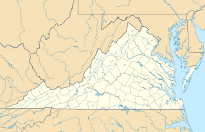
Lage in Virginia | ||
| Basisdaten | ||
| Staat: | Vereinigte Staaten | |
| Bundesstaat: | Virginia | |
| County: | Rockingham County | |
| Koordinaten: | 38° 41′ N, 78° 57′ W | |
| Zeitzone: | GMT-4 | |
| Höhe: | 396 m | |
| GNIS-ID: | 1495120 | |
Lage
Es liegt nordwestlich von Fulks Run im George Washington National Forest an der Virginia State Route 259.[1] Der Ort liegt am Fluss Marshall Run. Es gibt Zeltplätze und einige Häuser.
Die Lage von Yankeetown innerhalb des Rockingham County |
Einzelnachweise
- Google Maps. Abgerufen am 26. April 2022 (de-US).
На других языках
- [de] Yankeetown (Virginia)
[en] Yankeetown, Virginia
Yankeetown is an unincorporated community located in Rockingham County, in the U.S. state of Virginia.Текст в блоке "Читать" взят с сайта "Википедия" и доступен по лицензии Creative Commons Attribution-ShareAlike; в отдельных случаях могут действовать дополнительные условия.
Другой контент может иметь иную лицензию. Перед использованием материалов сайта WikiSort.org внимательно изучите правила лицензирования конкретных элементов наполнения сайта.
Другой контент может иметь иную лицензию. Перед использованием материалов сайта WikiSort.org внимательно изучите правила лицензирования конкретных элементов наполнения сайта.
2019-2025
WikiSort.org - проект по пересортировке и дополнению контента Википедии
WikiSort.org - проект по пересортировке и дополнению контента Википедии


