world.wikisort.org - Vereinigte_Staaten
Seymour ist eine Stadt im New Haven County im US-Bundesstaat Connecticut, Vereinigte Staaten, mit 16.300 Einwohnern (Stand: 2004). Die geographischen Koordinaten sind: 41,40° Nord, 73,08° West. Das Stadtgebiet hat eine Größe von 38,8 km².
| Seymour | |||
|---|---|---|---|
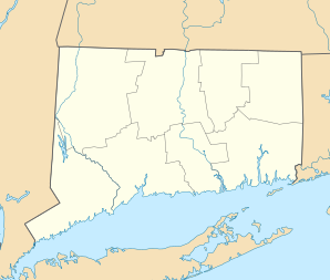
Lage in Connecticut | |||
| Basisdaten | |||
| Gründung: | 1850 | ||
| Staat: | Vereinigte Staaten | ||
| Bundesstaat: | Connecticut | ||
| County: | New Haven County | ||
| Koordinaten: | 41° 23′ N, 73° 5′ W | ||
| Zeitzone: | Eastern (UTC−5/−4) | ||
| Einwohner: | 16.748 (Stand: 2020) | ||
| Haushalte: | 6.297 (Stand: 2020) | ||
| Fläche: | 38,8 km² (ca. 15 mi²) davon 37,7 km² (ca. 15 mi²) Land | ||
| Bevölkerungsdichte: | 444 Einwohner je km² | ||
| Höhe: | 118 m | ||
| Postleitzahlen: | 06478, 06483 | ||
| Vorwahl: | +1 203 | ||
| FIPS: | 09-67610 | ||
| GNIS-ID: | 0213502 | ||
| Website: | www.seymourct.org | ||
Schulen
- Bungay School
- Paul E. Chatfield School
- Anna L. LoPresti School
- Seymour Middle School
- Seymour High School
Sehenswürdigkeiten
- Victorian Homes on the Hill
- French Park and Memorial
Weblinks
Commons: Seymour, Connecticut – Sammlung von Bildern, Videos und Audiodateien
На других языках
- [de] Seymour (Connecticut)
[en] Seymour, Connecticut
Seymour is a town located in New Haven County, Connecticut, United States. The population was 16,748 at the 2020 census.[2] Seymour is bordered by the towns of Oxford and Beacon Falls to the north, Bethany and Woodbridge to the east, Ansonia and Derby to the south, and Shelton to the west.Текст в блоке "Читать" взят с сайта "Википедия" и доступен по лицензии Creative Commons Attribution-ShareAlike; в отдельных случаях могут действовать дополнительные условия.
Другой контент может иметь иную лицензию. Перед использованием материалов сайта WikiSort.org внимательно изучите правила лицензирования конкретных элементов наполнения сайта.
Другой контент может иметь иную лицензию. Перед использованием материалов сайта WikiSort.org внимательно изучите правила лицензирования конкретных элементов наполнения сайта.
2019-2025
WikiSort.org - проект по пересортировке и дополнению контента Википедии
WikiSort.org - проект по пересортировке и дополнению контента Википедии