world.wikisort.org - Vereinigte_Staaten
Pottsville ist eine Kleinstadt im Pope County im US-Bundesstaat Arkansas. Sie liegt etwa 105 km westlich von Little Rock und etwa 135 km östlich von Fort Smith.
| Pottsville | |
|---|---|
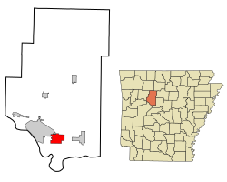 Lage im County und in Arkansas | |
| Basisdaten | |
| Staat: | Vereinigte Staaten |
| Bundesstaat: | Arkansas |
| County: | Pope County |
| Koordinaten: | 35° 15′ N, 93° 3′ W |
| Zeitzone: | Central (UTC−6/−5) |
| Einwohner: | 3.140 (Stand: 2020) |
| Haushalte: | 1.068 (Stand: 2020) |
| Fläche: | 19,4 km² (ca. 7 mi²) davon 19,4 km² (ca. 7 mi²) Land |
| Bevölkerungsdichte: | 162 Einwohner je km² |
| Höhe: | 116 m |
| Postleitzahl: | 72858 |
| Vorwahl: | +1 479 |
| FIPS: | 05-56990 |
| GNIS-ID: | 0078087 |
| Website: | www.cityofpottsville.com |
Nach der Volkszählung von 2000 zählte die Stadt eine Bevölkerung von 1271 Einwohnern. Sie nimmt eine Fläche von 19,5 km² ein. Pottsville grenzt im Norden an Crow Mountain, im Osten an Atkins und im Westen an Russellville.
Bevölkerungsentwicklung
| Bevölkerungsentwicklung | |||
|---|---|---|---|
| Census | Einwohner | ± rel. | |
| 1900 | 192 | — | |
| 1910 | 205 | 6,8 % | |
| 1920 | 275 | 34,1 % | |
| 1930 | 293 | 6,5 % | |
| 1940 | 308 | 5,1 % | |
| 1950 | 224 | −27,3 % | |
| 1960 | 250 | 11,6 % | |
| 1970 | 411 | 64,4 % | |
| 1980 | 564 | 37,2 % | |
| 1990 | 984 | 74,5 % | |
| 2000 | 1271 | 29,2 % | |
| 2020 | 3.140 | 10,6 % | |
| 1900–2000[1] | |||
Einzelnachweise
- Auszug aus der Encyclopedia of Arkansas. Abgerufen am 13. Februar 2011
На других языках
- [de] Pottsville (Arkansas)
[en] Pottsville, Arkansas
Pottsville is a city[2] in Pope County, Arkansas, United States. As of the 2020 census the population was 3,140. It is part of the Russellville Micropolitan Statistical Area.Текст в блоке "Читать" взят с сайта "Википедия" и доступен по лицензии Creative Commons Attribution-ShareAlike; в отдельных случаях могут действовать дополнительные условия.
Другой контент может иметь иную лицензию. Перед использованием материалов сайта WikiSort.org внимательно изучите правила лицензирования конкретных элементов наполнения сайта.
Другой контент может иметь иную лицензию. Перед использованием материалов сайта WikiSort.org внимательно изучите правила лицензирования конкретных элементов наполнения сайта.
2019-2025
WikiSort.org - проект по пересортировке и дополнению контента Википедии
WikiSort.org - проект по пересортировке и дополнению контента Википедии