world.wikisort.org - Vereinigte_Staaten
Los Alamitos ist eine Stadt im Orange County im US-Bundesstaat Kalifornien, Vereinigte Staaten, mit 11.700 Einwohnern (Stand: 2004). Die geographischen Koordinaten sind: 33,80° Nord, 118,06° West. Das Stadtgebiet hat eine Größe von 10,6 km².
| Los Alamitos | |||
|---|---|---|---|
 City Hall | |||
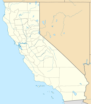
| Lage in Kalifornien | |||
| |||
| Basisdaten | |||
| Gründung: | 1. März 1960 | ||
| Staat: | Vereinigte Staaten | ||
| Bundesstaat: | Kalifornien | ||
| County: | Orange County | ||
| Koordinaten: | 33° 48′ N, 118° 4′ W | ||
| Zeitzone: | Pacific (UTC−8/−7) | ||
| Einwohner: | 11.780 (Stand: 2020) | ||
| Haushalte: | 4.115 (Stand: 2020) | ||
| Fläche: | 10,59 km² (ca. 4 mi²) davon 10,42 km² (ca. 4 mi²) Land | ||
| Bevölkerungsdichte: | 1.131 Einwohner je km² | ||
| Höhe: | 7 m | ||
| Postleitzahlen: | 90720, 90721 | ||
| Vorwahl: | +1 562 | ||
| FIPS: | 06-43224 | ||
| GNIS-ID: | 1652748 | ||
| Website: | cityoflosalamitos.org | ||
| Bürgermeister: | Kenneth Stephens | ||
Söhne und Töchter der Stadt
- Ralph Flanagan (1918–1988), Schwimmsportler und Olympiateilnehmer
- Mesinee Mangkalakiri (* 1983), Badmintonspielerin und Olympiateilnehmerin
- Marcedes Lewis (* 1984), American-Football-Spieler
- Halli Amaro (* 1993), Volleyballspielerin
- Rachel Fattal (* 1993), Wasserballspielerin
Weblinks
Commons: Los Alamitos – Album mit Bildern, Videos und Audiodateien
На других языках
- [de] Los Alamitos
[en] Los Alamitos, California
Los Alamitos (Spanish for '"The Little Cottonwoods"') is a city in Orange County, California. The city was incorporated in March 1960. The population was 11,780 at the 2020 census, up from 11,449 at the 2010 census. The adjacent unincorporated community of Rossmoor uses the same 90720 ZIP code in its mailing address, but is not part of the city. The Los Alamitos Race Course is named for the city, but lies in the neighboring city of Cypress.Текст в блоке "Читать" взят с сайта "Википедия" и доступен по лицензии Creative Commons Attribution-ShareAlike; в отдельных случаях могут действовать дополнительные условия.
Другой контент может иметь иную лицензию. Перед использованием материалов сайта WikiSort.org внимательно изучите правила лицензирования конкретных элементов наполнения сайта.
Другой контент может иметь иную лицензию. Перед использованием материалов сайта WikiSort.org внимательно изучите правила лицензирования конкретных элементов наполнения сайта.
2019-2026
WikiSort.org - проект по пересортировке и дополнению контента Википедии
WikiSort.org - проект по пересортировке и дополнению контента Википедии