world.wikisort.org - Uruguay
La Paloma is a small city in the Rocha Department of southeastern Uruguay.
La Paloma | |
|---|---|
City | |
 | |
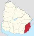
 La Paloma Location in Uruguay | |
| Coordinates: 34°39′0″S 54°10′0″W | |
| Country | |
| Department | |
| Founded | 1874 |
| Population (2011 Census) | |
| • Total | 3,495 |
| Time zone | UTC -3 |
| Postal code | 27001 |
| Dial plan | +598 4479 (+4 digits) |
| Climate | Cfb |
Location
The city is located on Km. 244 of Route 10 and on its junction with Route 15, on the coast of the Atlantic Ocean, about 8 kilometres (5.0 mi) southwest of La Pedrera and 53 kilometres (33 mi) northeast of Faro José Ignacio of the Maldonado Department.
History
It was founded on 1 September 1874.[1] Its status was elevated to "Pueblo" (village) on 8 November 1939 by the Act of Ley Nº 9.888[2] and on 18 October 1982 to "Ciudad" (city) by the Act of Ley Nº 15.333.[3] During the 1940s the resort was expanded according to plans designed by Juan Antonio Scasso.
Places of worship
- Parish Church of Our Lady of the Pigeon (Roman Catholic)
Population
In 2011 La Paloma had a population of 3,495 inhabitants [4] and 4,633 dwellings.[5]
| Year | Population | Dwellings |
|---|---|---|
| 1963 | 818 | 716 |
| 1975 | 1,389 | 1,297 |
| 1985 | 2,235 | 1,686 |
| 1996 | 3,084 | 2,814 |
| 2004 | 3,202 | 3,583 |
| 2011 | 3,495 | 4,633 |
Source: Instituto Nacional de Estadística de Uruguay[1][6]
References
- "Statistics of urban localities (1963–2004)". INE. 2012. Archived from the original (PDF) on 23 March 2015. Retrieved 5 September 2012.
- "LEY N° 9.888". República Oriental del Uruguay, Poder Legislativo. 1939. Archived from the original on 26 October 2014. Retrieved 2 July 2011.
- "Ley Nº 15.333". República Oriental del Uruguay, Poder Legislativo. 1982. Archived from the original on 26 October 2014. Retrieved 4 September 2012.
- "Censos 2011 Cuadros Rocha". INE. 2012. Archived from the original on 10 October 2012. Retrieved 25 August 2012.
- "Censos 2011 Rocha". INE. 2012. Archived from the original on 11 November 2012. Retrieved 25 August 2012.
- "1963–1996 Statistics / L". Instituto Nacional de Estadística de Uruguay. 2004. Archived from the original (DOC) on 29 November 2011. Retrieved 28 July 2011.
External links
| Resorts and Landforms |
|
|---|---|
| |
Capital: Rocha | ||
| Towns and villages |
|  |
| Sights | ||
Authority control | |
|---|---|
| General |
|
| National libraries | |
This article about a place in Rocha Department is a stub. You can help Wikipedia by expanding it. |
Другой контент может иметь иную лицензию. Перед использованием материалов сайта WikiSort.org внимательно изучите правила лицензирования конкретных элементов наполнения сайта.
WikiSort.org - проект по пересортировке и дополнению контента Википедии