world.wikisort.org - Regno_Unito
Youlgreave è un villaggio e parrocchia civile dell'Inghilterra, appartenente alla contea del Derbyshire.
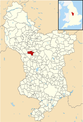
| Youlgreave parrocchia civile | |
|---|---|
 | |
| Localizzazione | |
| Stato | |
| Regione | Midlands Orientali |
| Contea | |
| Distretto | Derbyshire Dales |
| Territorio | |
| Coordinate | 53°10′30″N 1°41′13.2″W |
| Superficie | 10,18 km² |
| Abitanti | 1 190 (2011) |
| Densità | 116,91 ab./km² |
| Altre informazioni | |
| Cod. postale | DE45 |
| Fuso orario | UTC+0 |
| Cartografia | |
 Youlgreave | |
 | |
Altri progetti
 Wikimedia Commons contiene immagini o altri file su Youlgreave
На других языках
[en] Youlgreave
Youlgreave or Youlgrave listen (help·info) is a village and civil parish in the Peak District of Derbyshire, England, on the River Bradford .mw-parser-output .frac{white-space:nowrap}.mw-parser-output .frac .num,.mw-parser-output .frac .den{font-size:80%;line-height:0;vertical-align:super}.mw-parser-output .frac .den{vertical-align:sub}.mw-parser-output .sr-only{border:0;clip:rect(0,0,0,0);height:1px;margin:-1px;overflow:hidden;padding:0;position:absolute;width:1px}2+1⁄2 miles (4.0 km) south of Bakewell. The name possibly derives from "yellow grove", the ore mined locally being yellow in colour.[2][3][4][5] The population in 1991 was 1,256;[6] it is one of the largest villages in the Peak District National Park.- [it] Youlgreave
Текст в блоке "Читать" взят с сайта "Википедия" и доступен по лицензии Creative Commons Attribution-ShareAlike; в отдельных случаях могут действовать дополнительные условия.
Другой контент может иметь иную лицензию. Перед использованием материалов сайта WikiSort.org внимательно изучите правила лицензирования конкретных элементов наполнения сайта.
Другой контент может иметь иную лицензию. Перед использованием материалов сайта WikiSort.org внимательно изучите правила лицензирования конкретных элементов наполнения сайта.
2019-2025
WikiSort.org - проект по пересортировке и дополнению контента Википедии
WikiSort.org - проект по пересортировке и дополнению контента Википедии