world.wikisort.org - Regno_Unito
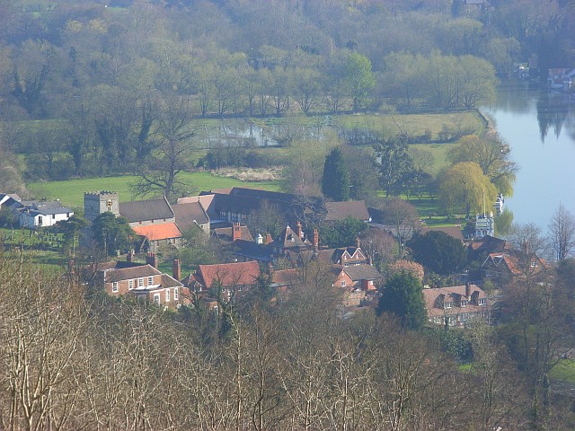
Streatley è un villaggio e parrocchia civile dell'Inghilterra, appartenente alla contea del Berkshire.
| Streatley parrocchia civile | |
|---|---|
 | |
| Localizzazione | |
| Stato | |
| Regione | Sud Est |
| Contea | |
| Distretto | West Berkshire |
| Territorio | |
| Coordinate | 51°31′22.8″N 1°09′00″W |
| Superficie | 13,14 km² |
| Abitanti | 1 060 (2011) |
| Densità | 80,67 ab./km² |
| Altre informazioni | |
| Cod. postale | RG8 |
| Prefisso | 01491 |
| Fuso orario | UTC+0 |
| Cartografia | |
 Streatley | |
| Sito istituzionale | |
Altri progetti
 Wikimedia Commons contiene immagini o altri file su Streatley (Berkshire)
Collegamenti esterni
- Sito ufficiale, su streatley.org.
На других языках
[en] Streatley, Berkshire
Streatley is a village and civil parish on the River Thames in Berkshire, England. The village faces Goring-on-Thames. The two places share in their shops, services, leisure, sports and much of their transport. Across the river is Goring & Streatley railway station and the village cluster adjoins a lock and weir. The west of the village is a mixture of agriculture and woodland plus a golf course. The village has a riverside hotel. Much of Streatley is at steeply varying elevations, ranging from 51m AOD to 185m at Streatley Warren, a hilltop point on its western border forming the eastern end of the Berkshire Downs. This Area of Outstanding Natural Beauty is topped by the 87-mile The Ridgeway path, which crosses the Thames at Goring and Streatley Bridge.- [it] Streatley (Berkshire)
Текст в блоке "Читать" взят с сайта "Википедия" и доступен по лицензии Creative Commons Attribution-ShareAlike; в отдельных случаях могут действовать дополнительные условия.
Другой контент может иметь иную лицензию. Перед использованием материалов сайта WikiSort.org внимательно изучите правила лицензирования конкретных элементов наполнения сайта.
Другой контент может иметь иную лицензию. Перед использованием материалов сайта WikiSort.org внимательно изучите правила лицензирования конкретных элементов наполнения сайта.
2019-2025
WikiSort.org - проект по пересортировке и дополнению контента Википедии
WikiSort.org - проект по пересортировке и дополнению контента Википедии