world.wikisort.org - Regno_Unito
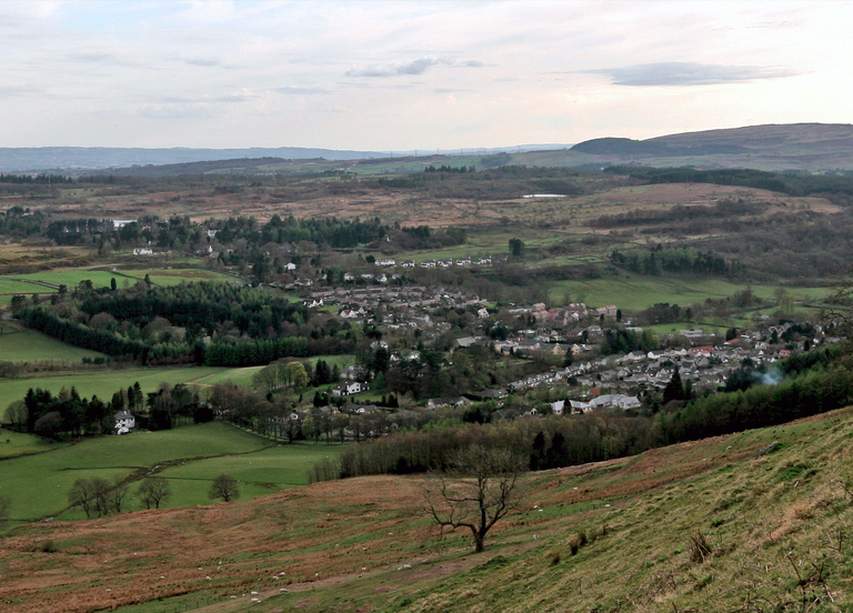
Strathblane (Strath Bhlàthain in lingua gaelica scozzese) è una località della Scozia, situata nell'area di consiglio di Stirling.
| Strathblane località | |
|---|---|
 | |
| Localizzazione | |
| Stato | |
| Area di consiglio | Stirling |
| Territorio | |
| Coordinate | 55°59′11.4″N 4°18′22.07″W |
| Superficie | 44,03 km² |
| Abitanti | 1 811 (2001) |
| Densità | 41,13 ab./km² |
| Altre informazioni | |
| Fuso orario | UTC+0 |
| Cartografia | |
 Strathblane | |
Altri progetti
 Wikimedia Commons contiene immagini o altri file su Strathblane
На других языках
[en] Strathblane
Strathblane (Scottish Gaelic: Strath Bhlàthain,[2] pronounced [s̪t̪ɾahˈvl̪ˠaː.ɪɲ]) is a village and parish in the registration county of Stirlingshire, situated in the southwestern part of the Stirling council area, in central Scotland. It lies at the foothills of the Campsie Fells and the Kilpatrick Hills on the Blane Water, 12 miles (19 km) north of Glasgow, 14 miles (23 km) east-southeast of Dumbarton, and 20 miles (32 km) southwest of Stirling. Strathblane is a dormitory village for Greater Glasgow, and has a total resident population of 1,811.[3]- [it] Strathblane
Текст в блоке "Читать" взят с сайта "Википедия" и доступен по лицензии Creative Commons Attribution-ShareAlike; в отдельных случаях могут действовать дополнительные условия.
Другой контент может иметь иную лицензию. Перед использованием материалов сайта WikiSort.org внимательно изучите правила лицензирования конкретных элементов наполнения сайта.
Другой контент может иметь иную лицензию. Перед использованием материалов сайта WikiSort.org внимательно изучите правила лицензирования конкретных элементов наполнения сайта.
2019-2025
WikiSort.org - проект по пересортировке и дополнению контента Википедии
WikiSort.org - проект по пересортировке и дополнению контента Википедии