world.wikisort.org - Regno_Unito
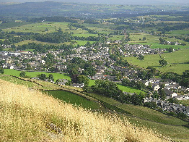
Staveley è un villaggio dell'Inghilterra, appartenente alla contea della Cumbria, della parrocchia civile di Nether Staveley e Over Staveley.
| Staveley parrocchia civile | |
|---|---|
 | |
| Localizzazione | |
| Stato | |
| Regione | Nord Ovest |
| Contea | |
| Distretto | South Lakeland |
| Territorio | |
| Coordinate | 54°22′32.23″N 2°49′08.18″W |
| Abitanti | 1 147 (2011) |
| Altre informazioni | |
| Cod. postale | LA8 |
| Prefisso | 01539 |
| Fuso orario | UTC+0 |
| Cartografia | |
 Staveley | |
Altri progetti
 Wikimedia Commons contiene immagini o altri file su Staveley (Cumbria)
Collegamenti esterni
- (EN) Staveley (Cumbria), su Enciclopedia Britannica, Encyclopædia Britannica, Inc.
На других языках
[en] Staveley, Cumbria
Staveley (grid reference SD469981) is a village in the South Lakeland district, in Cumbria, England. Historically part of Westmorland, it is situated 4 miles (6 km) northwest of Kendal where the River Kent is joined by its tributary the Gowan. It is also known as Staveley-in-Westmorland and Staveley-in-Kendal to distinguish it from Staveley-in-Cartmel (a small village near Newby Bridge which is now in Cumbria but was previously in Lancashire). There are three civil parishes – Nether Staveley, Over Staveley and Hugill (part). Their total population at the 2011 Census was 1,593 but this includes those living in the hamlet of Ings in Hugill parish.[1][2]- [it] Staveley (Cumbria)
Текст в блоке "Читать" взят с сайта "Википедия" и доступен по лицензии Creative Commons Attribution-ShareAlike; в отдельных случаях могут действовать дополнительные условия.
Другой контент может иметь иную лицензию. Перед использованием материалов сайта WikiSort.org внимательно изучите правила лицензирования конкретных элементов наполнения сайта.
Другой контент может иметь иную лицензию. Перед использованием материалов сайта WikiSort.org внимательно изучите правила лицензирования конкретных элементов наполнения сайта.
2019-2025
WikiSort.org - проект по пересортировке и дополнению контента Википедии
WikiSort.org - проект по пересортировке и дополнению контента Википедии