world.wikisort.org - Regno_Unito
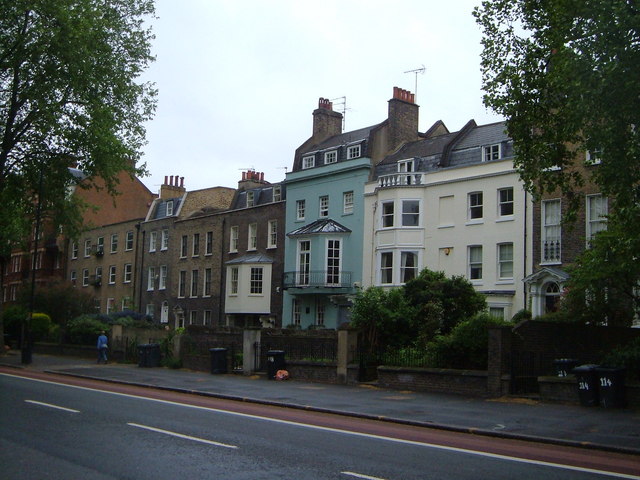
Kennington è un distretto a sud di Londra. È tra i maggiori del Borough di Lambeth, confinante con il Borough di Southwark, un confine che può essere individuato, nel piano di Londra, nelle medievali prime parrocchie di Lambeth e St. George.[2] Si trova a circa 2,3 km a sud di Charing Cross nella Inner London. Era maniero reale nella antica parrocchia di St. Mary (Lambeth) nella contea del Surrey e fu il centro amministrativo della parrocchia dal 1853. Prossima al Central London fu determinante per lo sviluppo dell'area come sobborgo residenziale, e con il Management Act 1855 venne incorporata nell'area metropolitana della Grande Londra nel 1855.
| Kennington Distretto di Londra | |
|---|---|
 | |
| Localizzazione | |
| Stato | |
| Regione | Non presente |
| Contea | |
| Territorio | |
| Coordinate | 51°28′52.68″N 0°07′10.92″W |
| Abitanti | 15 106[1] |
| Altre informazioni | |
| Cod. postale | SE11 |
| Fuso orario | UTC+0 |
| Cartografia | |
 | |
Kennington possiede tre punti di riferimento di Londra: The Oval campo da cricket, l'Imperial War Museum e il Kennington Park. La sua popolazione, al Censimento del Regno Unito del 2011, era di 15 106 abitanti.
Note
- Censimento del 2011
- Stratus Connect, su maps.southwark.gov.uk. URL consultato il 15 agosto 2013 (archiviato dall'url originale il 21 gennaio 2013).
Altri progetti
 Wikimedia Commons contiene immagini o altri file su Kennington
Collegamenti esterni
| Controllo di autorità | VIAF (EN) 235138783 |
|---|
На других языках
[en] Kennington
Kennington is a district in south London, England. It is mainly within the London Borough of Lambeth, running along the boundary with the London Borough of Southwark, a boundary which can be discerned from the early medieval period between the Lambeth and St George's parishes of those boroughs respectively.[1] It is located 1.4 miles (2.3 km) south of Charing Cross in Inner London and is identified as a local centre in the London Plan. It was a royal manor in the parish of St Mary, Lambeth in the county of Surrey and was the administrative centre of the parish from 1853. Proximity to central London was key to the development of the area as a residential suburb and it was incorporated into the metropolitan area of London in 1855.- [it] Kennington
[ru] Кеннингтон
Ке́ннингтон (англ. Kennington) — район в южной части Лондона. Большая часть района расположена в лондонском боро Ламбет, проходя вдоль границы с боро Саутуарк, которая с раннего средневековья прослеживается между общинами Ламбет и Сент-Джордж этих боро соответственно[1]. Расположен в 2,3 км к югу от Чаринг-Кросс во Внутреннем Лондоне и в Плане Лондона определяется как местный центр. Кеннингтон был одним из королевских имений старинной общины Сент-Мэри[en] в графстве Суррей и являлся административным центром общины с 1853 года. Близость к центру города стала ключевым фактором развития района как жилого пригорода, и в 1855 году он был включён в городскую агломерацию Лондона.Другой контент может иметь иную лицензию. Перед использованием материалов сайта WikiSort.org внимательно изучите правила лицензирования конкретных элементов наполнения сайта.
WikiSort.org - проект по пересортировке и дополнению контента Википедии