world.wikisort.org - Regno_Unito
Colkirk è un villaggio e parrocchia civile dell'Inghilterra, appartenente alla contea del Norfolk.
| Colkirk parrocchia civile | |
|---|---|
 | |
| Localizzazione | |
| Stato | |
| Regione | Est |
| Contea | |
| Distretto | Breckland |
| Territorio | |
| Coordinate | 52°48′03.89″N 0°50′32.03″E |
| Superficie | 10,6 km² |
| Abitanti | 588 (2011) |
| Densità | 55,47 ab./km² |
| Altre informazioni | |
| Cod. postale | NR21 |
| Fuso orario | UTC+0 |
| Cartografia | |
 Colkirk | |
| Sito istituzionale | |
Altri progetti
 Wikimedia Commons contiene immagini o altri file su Colkirk
Collegamenti esterni
- Sito ufficiale, su colkirk-norfolk.co.uk.
- (EN) Sito web istituzionale del Norfolk, su norfolk.gov.uk.
На других языках
[en] Colkirk
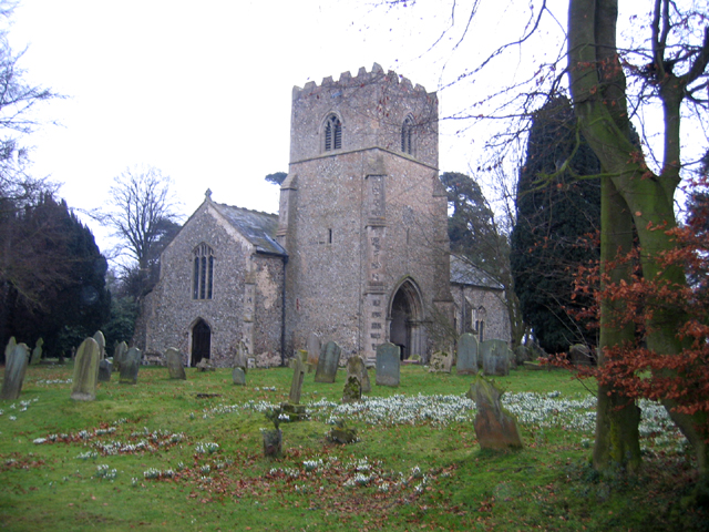
Colkirk is a village (population 2001-547) situated about two miles south of Fakenham in the county of Norfolk, England. Dating from at least the time of the Domesday Book. The village including Oxwick , Pattesley and South Raynham currently (2011) has 588 inhabitants living in 266 dwellings. The village has a church, (St. Mary's), in the north west corner of the village, a Village Hall, a church pond (known as the Church Pit in Norfolk dialect), a Camping Land (land once used for the game Camping, "camp" meaning battle in Old English). There is also a thriving village school for students from the age of four to eleven, a lively village Pub called "The Crown" and a playing field for soccer, cricket, rounders and school sports days.- [it] Colkirk
Текст в блоке "Читать" взят с сайта "Википедия" и доступен по лицензии Creative Commons Attribution-ShareAlike; в отдельных случаях могут действовать дополнительные условия.
Другой контент может иметь иную лицензию. Перед использованием материалов сайта WikiSort.org внимательно изучите правила лицензирования конкретных элементов наполнения сайта.
Другой контент может иметь иную лицензию. Перед использованием материалов сайта WikiSort.org внимательно изучите правила лицензирования конкретных элементов наполнения сайта.
2019-2026
WikiSort.org - проект по пересортировке и дополнению контента Википедии
WikiSort.org - проект по пересортировке и дополнению контента Википедии