world.wikisort.org - Regno_Unito
Capel Curig (200 ab. ca.) è una comunità del Galles nord-occidentale, appartenente al distretto di contea di Conwy (contea tradizionale: Gwynedd) e situata nel parco nazionale di Snowdonia[2][3][4] e lungo il corso del fiume Llugwy[3]. È una delle più antiche stazioni di montagna della zona.[4]
| Capel Curig comunità | |
|---|---|
 | |
| Localizzazione | |
| Stato | |
| Area principale | Conwy |
| Territorio | |
| Coordinate | 53°06′18″N 3°54′46.8″W |
| Abitanti | 226 (2001[1]) |
| Altre informazioni | |
| Cod. postale | LL24 |
| Prefisso | (+44) 01690 |
| Fuso orario | UTC+0 |
| Cartografia | |
 Capel Curig | |
| Sito istituzionale | |
Geografia fisica
Capel Curig si trova tra Llanberis e Betws-y-Coed (rispettivamente ad est della prima e ad ovest dalla seconda)[5] e tra Bethesda e Beddgelert (rispettivamente a sud-est della prima e a nord-est della seconda)[5], a circa 28 km[6] a nord di Blaenau Ffestiniog.
Origini del nome
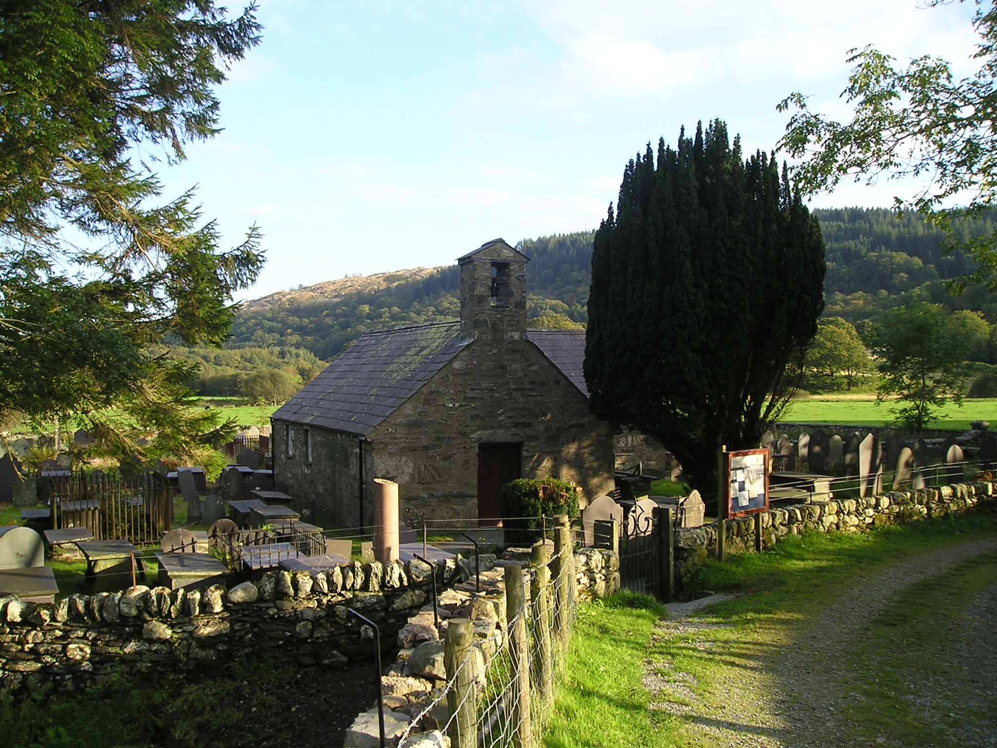
Il toponimo Capel Curig significa letteralmente "Chiesa di San Curig" e fa riferimento ad una chiesa eretta nell VI secolo e ricostruita nel XIII-XIV secolo dedicata in origine a San Curig, ma ribattezzata nel XIX secolo St Julitta's Church, in onore della madre di San Curig, quando fu costruita una nuova Chiesa di San Curig.[3][7]
Monumenti e luoghi d'interesse
Società
Evoluzione demografica
Al censimento del 2001, la community di Capel Curig contava una popolazione di 226 abitanti, di cui 105 donne e 121 uomini.[1]
Cultura
Musica
- La località di Capel Curig è menzionata nel brano della band britannica Half Man Half Biscuit Bottleneck at Capel Curig, brano che fa parte dell'album Trouble Over Bridgwater[8]
Note
- Neighbourhood Statistics: Conwy (Unitary Authority)
- Visit Capel Curig - Home, su visitcapel.fsnet.co.uk. URL consultato il 6 ottobre 2011 (archiviato dall'url originale il 25 novembre 2005).
- Wales Directory: Capel Curig
- King, John, Galles, Lonely Planet, Victoria, 2001 - EDT, Torino, p. 329
- ViaMichelin.it: Mappa di Capel Curig, su viamichelin.it. URL consultato il 23 marzo 2021 (archiviato dall'url originale il 13 aprile 2013).
- ViaMichelin.it: Itinerario da Capel Curig a Blaenau Ffestiniog
- BBC: Capel Curig churches and chapels
- All Music: Trouble Over Bridgwater
Altri progetti
 Wikimedia Commons contiene immagini o altri file su Capel Curig
Collegamenti esterni
- Visit Capel Curig, su visitcapel.fsnet.co.uk. URL consultato il 6 ottobre 2011 (archiviato dall'url originale il 25 novembre 2005).
- Capel Curig su Wales Directory
- Mappa di Capel Curig, su ViaMichelin.it. URL consultato il 23 marzo 2021 (archiviato dall'url originale il 13 aprile 2013).
- Capel Curig churches and chapels sul sito della BBC
На других языках
[en] Capel Curig
Capel Curig (Welsh pronunciation: [ˈkɑːpɛl ˈkɨːrɪɡ]; meaning "Curig's Chapel") is a village and community in the historic county of Caernarfonshire, currently administered as part of the unitary authority of Conwy County Borough, in Wales. It lies in the heart of Snowdonia, on the River Llugwy, and has a population of 226,[1] reducing slightly to 206 at the 2011 census.[2] It lies at the junction of the A5 road from Bangor and Bethesda to Betws-y-Coed with the A4086 road from Caernarfon, Llanberis, Pen-y-Pass and Pen-y-Gwryd. It is surrounded by hills and mountains, including Moel Siabod and Pen Llithrig y Wrach.- [it] Capel Curig
Другой контент может иметь иную лицензию. Перед использованием материалов сайта WikiSort.org внимательно изучите правила лицензирования конкретных элементов наполнения сайта.
WikiSort.org - проект по пересортировке и дополнению контента Википедии