world.wikisort.org - Regno_Unito
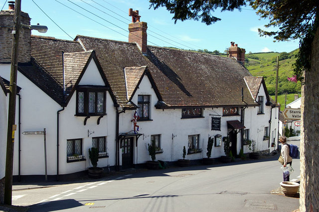
Berrynarbor è un villaggio e parrocchia civile dell'Inghilterra, appartenente alla contea del Devon.
| Berrynarbor parrocchia civile | |
|---|---|
 | |
| Localizzazione | |
| Stato | |
| Regione | Sud Ovest |
| Contea | Devon |
| Distretto | North Devon |
| Territorio | |
| Coordinate | 51°12′00″N 4°04′00.01″W |
| Abitanti | 802 (2011) |
| Altre informazioni | |
| Fuso orario | UTC+0 |
| Cartografia | |
 Berrynarbor | |
Altri progetti
 Wikimedia Commons contiene immagini o altri file su Berrynarbor
На других языках
[en] Berrynarbor
Berrynarbor (historically Berry Narbor, Berrie Nerbert, etc) is a village, civil parish and former manor in the North Devon district of Devon, England. According to the 2001 census the parish had a population of 749, increasing to 802 at the 2011 census.[1] The village is located on the north coast of the county to the north of Exmoor, about three miles east of Ilfracombe. The parish is surrounded clockwise from the east by the parishes of Combe Martin, Kentisbury, East Down, Marwood, Bittadon, and Ilfracombe.[2] Berrynarbor has within its purview to all sides a mixture of dense woodlands and farms and lies within the North Devon Area of Outstanding Natural Beauty.[3]- [it] Berrynarbor
Текст в блоке "Читать" взят с сайта "Википедия" и доступен по лицензии Creative Commons Attribution-ShareAlike; в отдельных случаях могут действовать дополнительные условия.
Другой контент может иметь иную лицензию. Перед использованием материалов сайта WikiSort.org внимательно изучите правила лицензирования конкретных элементов наполнения сайта.
Другой контент может иметь иную лицензию. Перед использованием материалов сайта WikiSort.org внимательно изучите правила лицензирования конкретных элементов наполнения сайта.
2019-2026
WikiSort.org - проект по пересортировке и дополнению контента Википедии
WikiSort.org - проект по пересортировке и дополнению контента Википедии