world.wikisort.org - Regno_Unito
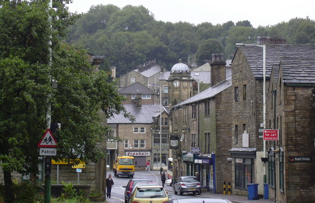
Bacup è un paese di 12.763 abitanti del Lancashire, in Inghilterra.
| Bacup parrocchia civile | |
|---|---|
 | |
| Localizzazione | |
| Stato | |
| Regione | Nord Ovest |
| Contea | |
| Distretto | Rossendale |
| Territorio | |
| Coordinate | 53°42′N 2°12′W |
| Abitanti | 12 763 (2001) |
| Altre informazioni | |
| Cod. postale | OL13 |
| Prefisso | 01706 |
| Fuso orario | UTC+0 |
| Cartografia | |
 Bacup | |
Altri progetti
 Wikimedia Commons contiene immagini o altri file su Bacup
Collegamenti esterni
- Bacup, su sapere.it, De Agostini.
| Controllo di autorità | VIAF (EN) 132541393 · LCCN (EN) n82028278 · GND (DE) 4631695-4 · WorldCat Identities (EN) lccn-n82028278 |
|---|
На других языках
[de] Bacup
Bacup ist eine englische Kleinstadt im Borough of Rossendale in der Grafschaft Lancashire, die beim Zensus 2011 etwas mehr als 13.000 Einwohner hatte.[1][en] Bacup
Bacup (/ˈbeɪkəp/ BAY-kəp,[1] /ˈbeɪkʊp/) is a town in the Rossendale Borough in Lancashire, England, in the South Pennines close to Lancashire's boundaries with West Yorkshire and Greater Manchester. The town is in the Rossendale Valley and the upper Irwell Valley, 4 miles (6.4 km) east of Rawtenstall, 6 miles (9.7 km) north of Rochdale, and 7 miles (11 km) south of Burnley. At the 2011 Census, Bacup had a population of 13,323.[2]- [it] Bacup
Текст в блоке "Читать" взят с сайта "Википедия" и доступен по лицензии Creative Commons Attribution-ShareAlike; в отдельных случаях могут действовать дополнительные условия.
Другой контент может иметь иную лицензию. Перед использованием материалов сайта WikiSort.org внимательно изучите правила лицензирования конкретных элементов наполнения сайта.
Другой контент может иметь иную лицензию. Перед использованием материалов сайта WikiSort.org внимательно изучите правила лицензирования конкретных элементов наполнения сайта.
2019-2026
WikiSort.org - проект по пересортировке и дополнению контента Википедии
WikiSort.org - проект по пересортировке и дополнению контента Википедии