world.wikisort.org - Regno_Unito
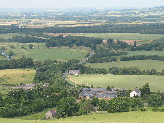
Akeld è un villaggio e parrocchia civile dell'Inghilterra, situata nella contea del Northumberland.
| Akeld parrocchia civile | |
|---|---|
 | |
| Localizzazione | |
| Stato | |
| Regione | Nord Est |
| Contea | |
| Distretto | Northumberland |
| Territorio | |
| Coordinate | 55°33′32.4″N 2°04′22.8″W |
| Abitanti | 221 (2011) |
| Altre informazioni | |
| Prefisso | 01668 |
| Fuso orario | UTC+0 |
| Cartografia | |
 Akeld | |
Altri progetti
 Wikimedia Commons contiene immagini o altri file su Akeld
На других языках
[en] Akeld
Akeld is a village and civil parish in Northumberland, England. It is situated around 2.7 miles (4.3 km) to the west of Wooler and 9.3 miles (15.0 km) from the border with Scotland at Coldstream. The village lies on the northern limit of Northumberland National Park and on the foot of the Cheviot Hills massif. It is overlooked by Akeld Hill and Harehope Hill to the south. In 2001 Akeld had a population of 82,[1] increasing at the 2011 Census to 221, although this was partly due to the parish merging with that of Kirknewton.[2] The burn which runs through the village and down to the Milfield Basin also bears the name Akeld.- [it] Akeld
Текст в блоке "Читать" взят с сайта "Википедия" и доступен по лицензии Creative Commons Attribution-ShareAlike; в отдельных случаях могут действовать дополнительные условия.
Другой контент может иметь иную лицензию. Перед использованием материалов сайта WikiSort.org внимательно изучите правила лицензирования конкретных элементов наполнения сайта.
Другой контент может иметь иную лицензию. Перед использованием материалов сайта WikiSort.org внимательно изучите правила лицензирования конкретных элементов наполнения сайта.
2019-2025
WikiSort.org - проект по пересортировке и дополнению контента Википедии
WikiSort.org - проект по пересортировке и дополнению контента Википедии